Gaumukh Tapovan Trek

4,463 M

Max Altitude Tapovan meadow

45 KM

Trek Distance Gangotri to Tapovan

8 DAYS

Duration 7 nights

Difficulty

Difficulty Prior trek required

MAY–JUN · SEP–OCT

Best Months Closed in winter

MAX 12

Group Size Gangotri base

Gaumukh Tapovan Trek: The Complete Guide to the Ganga's Source

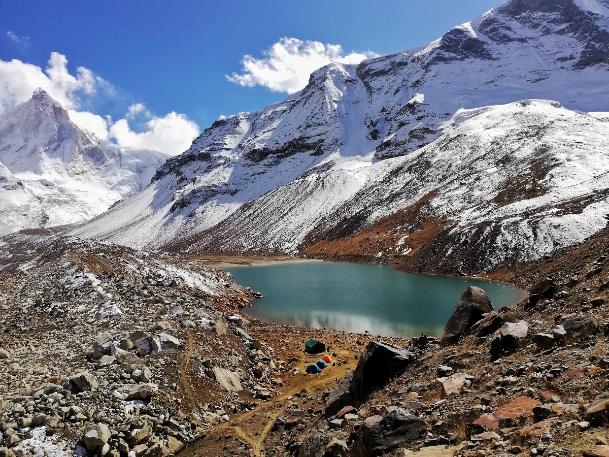
The Gaumukh Tapovan trek takes you to the glacial mouth where the Ganga is born, and then further still, up a steep moraine climb to Tapovan — a high-altitude meadow at 4,463 m sitting almost close enough to touch the sheer granite face of Shivling peak. This is not a beginner trek. It’s rated Difficult, runs 45 km over 8 days, and is built for trekkers who already have real Himalayan mileage behind them and are ready for something considerably bigger.

Few treks in India combine this much spiritual weight with this much physical demand. You begin at the Gangotri temple, walk for two days along the Bhagirathi River through cedar and pine forest, then climb past the snout of the Gangotri glacier itself — Gaumukh, literally “cow’s mouth,” the point where centuries of pilgrims have identified the Ganga’s origin — before pushing on to a campsite that puts you closer to Shivling’s 6,543 m summit than almost anywhere else you can walk to without a mountaineering permit.

Quick Facts
Duration 6 Days / 5 Nights (4 trekking days)
Trek Distance 24 km
Max Altitude 3,408 m (11,181 ft)
Difficulty Easy – Moderate
Base Village Raithal (also accessible via Barsu)
Distance from Dehradun 185–190 km (7–8 hour drive)
Best Time April–June, October–November, December–March (winter/skiing)
Trek Price ₹8,999 + 5% GST (all-inclusive)
Minimum Age 10 years

About Gaumukh Tapovan Trek

Gaumukh is the snout of the Gangotri glacier, and in Hindu tradition it’s regarded as the literal source of the River Ganga — the point where snowmelt from one of the Himalayas’ largest glaciers becomes the river that defines much of Indian civilization downstream. Pilgrims have made the journey here for centuries, though very few go beyond Gaumukh itself. The Gaumukh Tapovan trek does — continuing past the glacier snout, up a demanding moraine climb, to Tapovan, a stark, wind-scoured meadow at 4,463 m directly beneath Shivling’s near-vertical granite pyramid.

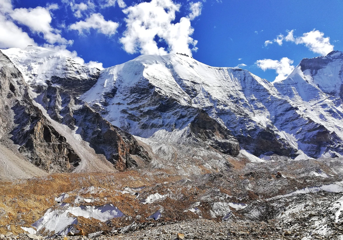
The trek starts at Gangotri, a temple town at 3,100 m that’s the last proper settlement before the wilderness of Gangotri National Park takes over. From there, it’s two days of trekking through forest and then increasingly barren, rocky terrain — Chirbasa on Day 2, Bhojbasa on Day 3 — before the push to Gaumukh and Tapovan on Day 4. Tapovan itself is one of the more otherworldly campsites in the Indian Himalayas: a small, isolated meadow surrounded almost entirely by rock, ice, and vertical granite, with Shivling rising directly in front of you and Meru and the Bhagirathi peaks completing the amphitheater.

This isn’t a trek to underestimate. The altitude is real — at 4,463 m you’re higher than Dayara Bugyal or Surya Top by a significant margin — and the terrain includes sustained moraine crossings (loose glacial rock and rubble that’s genuinely harder walking than a standard trail) plus one long, demanding descent day covering 15 km. We only recommend this trek to trekkers who’ve completed at least one prior Himalayan trek at moderate-or-harder difficulty.

If you’re newer to Himalayan trekking and this route appeals to you for its scenery rather than its specific difficulty, our Surya Top trek or Dayara Bugyal trek are better starting points — both are in the same broader Uttarkashi region and give you a gentler introduction before you consider a trek like this one.

TREK PRICE
₹17999/-
+ 5% GST · all-inclusive · Dehradun to Dehradun
Book Your Trek
Wilderness first-aid certified leaders
Support before, during and after

Why Trek Gaumukh Tapovan

The Source of the Ganga

Standing at Gaumukh, watching the Bhagirathi River emerge directly from ice, is a different kind of experience than most trek highlights — it’s not just a view, it’s the literal origin point of a river that over 400 million people downstream depend on. Whatever your own relationship to the spiritual significance, it’s genuinely hard to stand there and not register the weight of the place.

Shivling Peak, Up Close

Shivling (6,543 m) is one of the most photographed peaks in the Garhwal Himalayas, and Tapovan is where you see it closest and most directly — a near-vertical granite spire rising straight out of the meadow you’re camping in, with none of the intervening ridgelines or foreground clutter that most Himalayan viewpoints have to work around.

A Genuine Glacier Encounter

This trek puts you on and alongside the Gangotri glacier — one of the largest glaciers in the Himalayas — in a way very few non-technical treks in India do. Walking the moraine, crossing sections of exposed glacial ice, and camping within sight of the glacier’s upper reaches is a fundamentally different experience than a forest-and-meadow trek.

The glacier itself stretches roughly 30 km back into the mountains beyond Gaumukh — what you see at the snout is only the visible terminus of a vastly larger ice system feeding down from peaks including Chaukhamba. Trekkers with a genuine interest in glaciology or mountaineering history often find this one of the more intellectually engaging stretches of any trek in our lineup, not just a scenic backdrop.

Gangotri Temple

The trek begins and ends at one of the four sacred Char Dham sites, and the Day 1 evening darshan at Gangotri Temple — before you’ve even started trekking — sets a tone for the trip that’s genuinely distinct from a purely recreational Himalayan trek.

A Trek for Trekkers, Not Tourists

Because of the difficulty grading, altitude, and terrain, Gaumukh Tapovan sees a fraction of the foot traffic that more accessible pilgrimage routes in the region get. If you’re looking for a trek that rewards genuine trekking experience rather than a route built for maximum accessibility, this is one of the more serious options in our lineup.

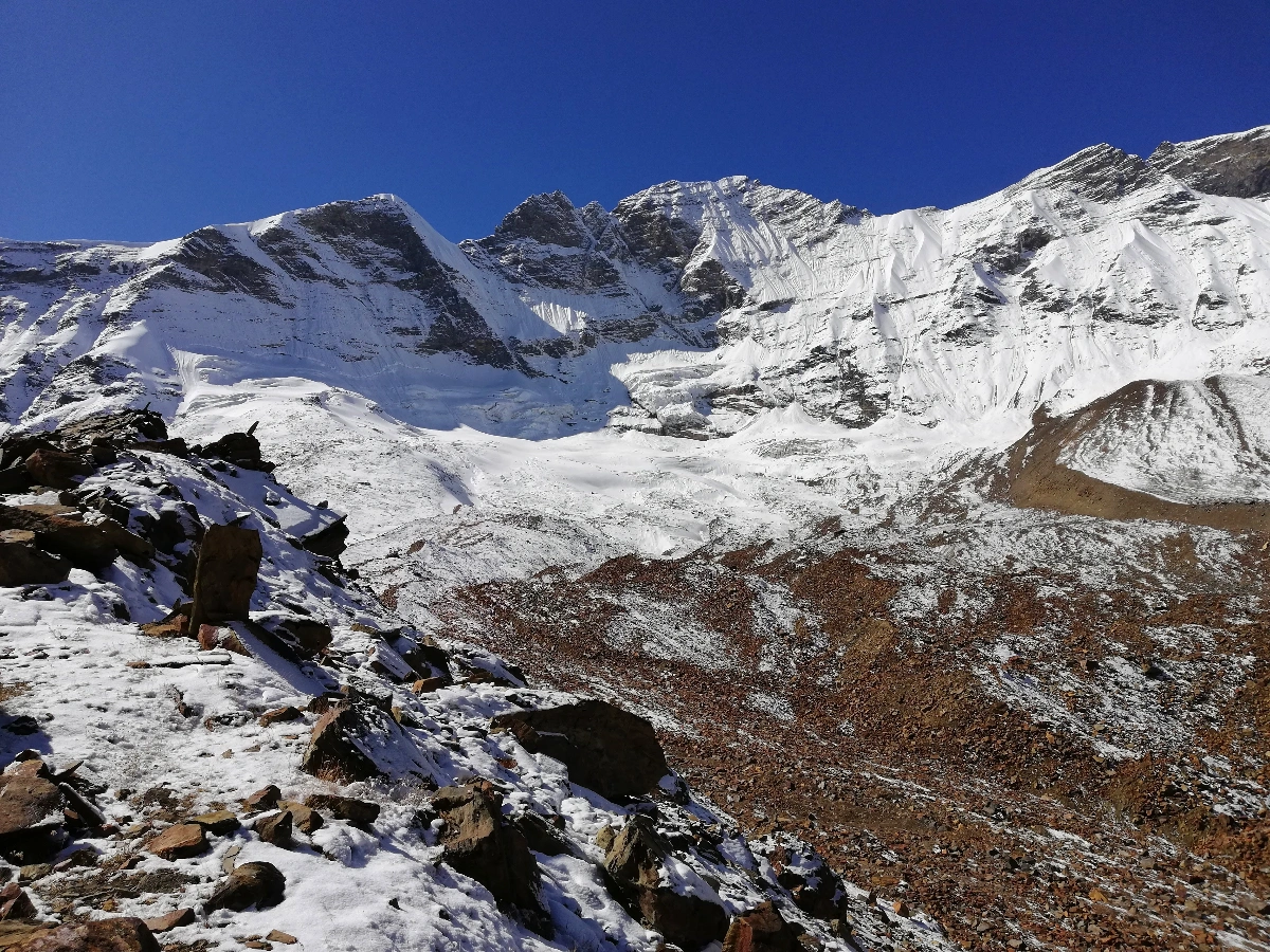
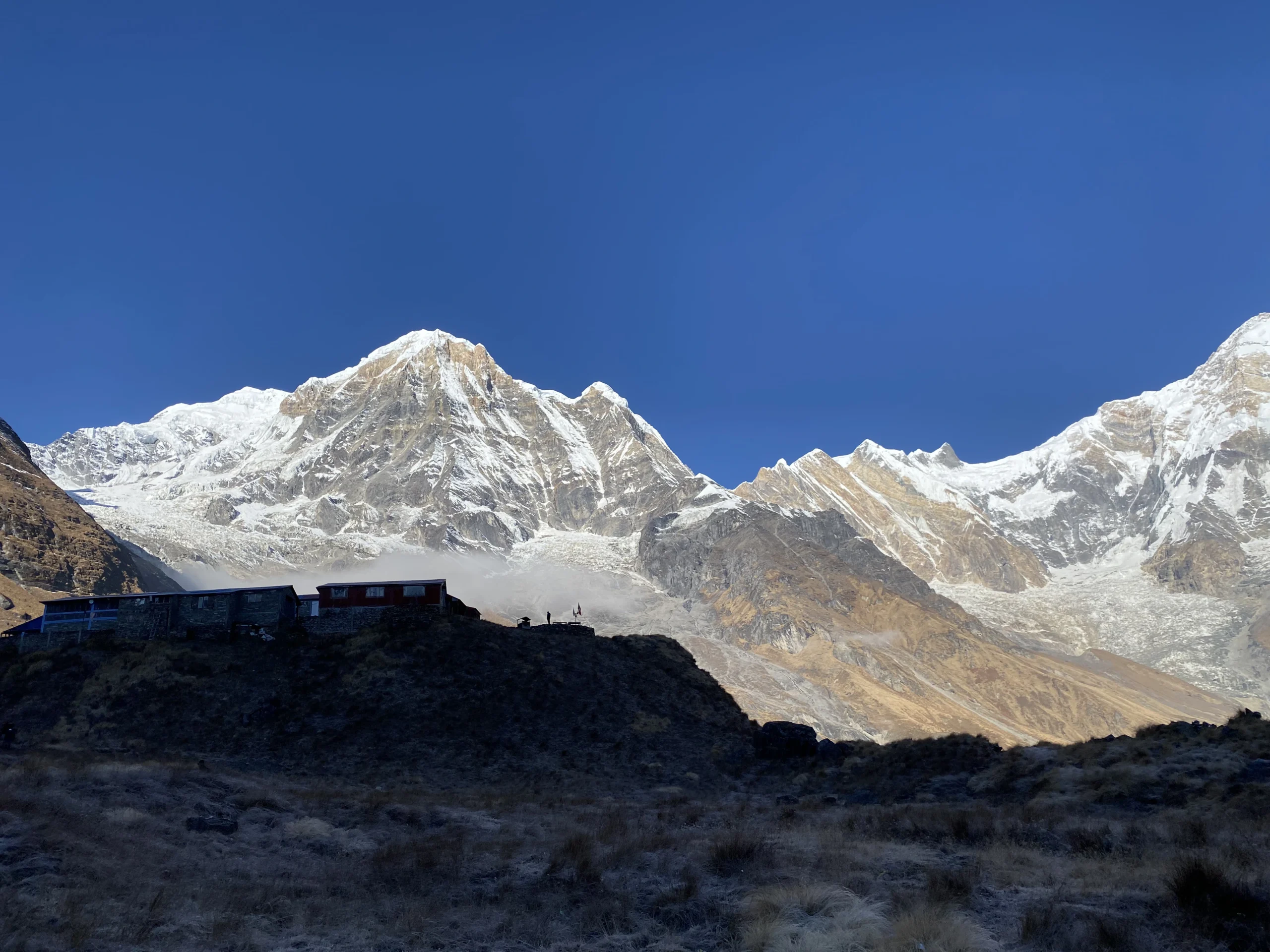
View of Gaumukh Tapovan Trek

Gaumukh Tapovan Trek Itinerary — Day by Day

A 7-day, ~45–46 km round trip starting and ending at Gangotri — climbing gradually through Chirbasa and Bhojbasa before reaching Gaumukh Glacier and the high-altitude meadows of Tapovan at 4,463 m.

1

DAY

An early pickup from Dehradun for a long but genuinely scenic drive via Uttarkashi, following the Bhagirathi River valley most of the way. You’ll arrive in Gangotri by evening, with time for darshan at the Gangotri Temple — the traditional starting point for this pilgrimage route — before an overnight stay in a guesthouse.

2

DAY

The trail follows the Bhagirathi River out of Gangotri through cedar and pine forest — genuinely beautiful walking, and the last proper forest cover you’ll see on this trek. Chirbasa, meaning “place of pine trees,” sits at the edge of where the forest starts thinning, with early views of the Bhagirathi peaks appearing through gaps in the tree line. Camping here.

3

DAY

A shorter day, deliberately paced for acclimatization, through increasingly rocky, alpine terrain as the last of the tree cover disappears. Bhojbasa is where you get your first real, close view of both Shivling peak and the edge of the Gangotri glacier itself — a preview of what Day 4 delivers in full. Camping here, at the last proper campsite before the trek’s most demanding day.

4

DAY

The defining day of the trek. You’ll reach Gaumukh first — the snout of the Gangotri glacier and the traditional source point of the Ganga — before tackling the genuinely demanding moraine climb up to Tapovan. This section is loose rock and glacial rubble rather than a maintained trail, and it’s the single hardest stretch on the entire route: steep, unstable underfoot, and at an altitude where every step costs more than it would lower down. Reaching Tapovan and getting your first full view of Shivling directly ahead is, by a wide margin, what most trekkers say the entire trip was for. Camping at Tapovan.

5

DAY

A buffer and acclimatization day built into the itinerary deliberately — both to let your body recover before the demanding descent and to give you time to actually experience Tapovan rather than rushing through it. Most groups walk toward the base of Shivling for closer photographs, and this is generally regarded as the best single day for photography on the entire trek. It’s also, practically, a safety buffer — if weather or altitude has slowed the group down, this day absorbs that without disrupting the rest of the itinerary.

6

DAY

The longest single day of the trek by distance, retracing the moraine descent past Gaumukh and back down through Bhojbasa to Chirbasa. It’s a long day, but almost entirely downhill, which makes the distance more manageable than it might sound — that said, descending the moraine section requires just as much care and attention as climbing it did on Day 4.

7

DAY

The final trekking day, descending back through the forest to Gangotri. Most groups arrive with enough of the afternoon left for a second, more relaxed visit to the Gangotri Temple, and an evening to unwind in the town after six days of increasingly demanding trekking.

8

DAY

The long return drive to Dehradun, with certificates distributed en route or on arrival. As with any Himalayan trek involving a full-day return drive, avoid booking same-evening onward travel — plan for arrival in Dehradun by evening and onward travel the following day.

Gaumukh Tapovan Trek Difficulty — Why It's Rated Difficult

Is the Gaumukh Tapovan trek difficult? Yes — this is genuinely one of the more demanding treks in our lineup, and the Difficult rating reflects three specific factors: the altitude (4,463 m, considerably higher than a standard meadow trek), the Day 4 moraine climb, and the sheer sustained distance across 8 days.

The moraine sections

Both the climb to Tapovan on Day 4 and the descent on Day 6 cross glacial moraine — loose rock and rubble left behind by the glacier’s movement, rather than a maintained dirt trail. This terrain is slower, more tiring, and demands more careful foot placement than forest or meadow walking. It’s not technical climbing (no ropes or specialized gear required), but it is genuinely harder walking than most treks in this region.

Altitude and total elevation gain

You gain roughly 1,363 metres across the trek, topping out at 4,463 m — high enough that AMS is a real and meaningfully more serious consideration than on a trek like Dayara Bugyal or even Surya Top. The itinerary’s built-in buffer day at Tapovan (Day 5) exists specifically to manage this.

What should I know about AMS on this specific trek?

At 4,463 m, mild-to-moderate AMS symptoms are a genuine possibility even for fit, experienced trekkers, and this altitude sits closer to the range where more serious altitude illness (HAPE, HACE) — while still uncommon — needs to be actively watched for rather than treated as a remote theoretical risk. Our trek leaders monitor vitals more closely on this route than on our easier treks, and the pace on Day 4 and Day 5 specifically is set to prioritize acclimatization over speed.

Distance and sustained effort

Day 4 (10 km, 7-8 hours, with the moraine climb) and Day 6 (15 km descent) are both long days by any standard, and they come after several consecutive days of trekking rather than as isolated efforts. Cumulative fatigue is a real factor on this trek in a way it generally isn’t on a shorter itinerary.

Fitness benchmark

This is not a trek for a first Himalayan attempt. We’d recommend having completed at least one moderate-or-harder Himalayan trek previously, and being able to comfortably walk 12-15 km on varied, uneven terrain, or run 5-6 km in under 30 minutes, in the weeks before departure. Prior experience specifically with multi-day trekking (rather than single strenuous day hikes) matters more here than raw fitness alone — your body needs to handle sustained effort across a full week, not just one hard day.

Who this trek suits

Who should look elsewhere first

A Simple Preparation Timeline

Given this trek’s difficulty, we’d recommend starting preparation at least 6-8 weeks out if your current fitness baseline isn’t already close to the benchmark above. Weeks one through three: build a consistent walking or jogging base, aiming to comfortably cover 8-10 km. Weeks four through six: add elevation-specific training — stairs, an incline treadmill, or actual hill walks if you have access to them, since flat-ground cardio alone doesn’t fully prepare your legs for sustained moraine climbing. In the final two weeks, taper rather than push harder; arriving rested matters more at this altitude than arriving at peak conditioning from a training block that left you fatigued.

If you already trek regularly at a moderate-to-difficult grade, a few weekend hikes with real elevation gain in the month before departure should be sufficient.

Best Time for Gaumukh Tapovan Trek — Season by Season

When is the best time for the Gaumukh Tapovan trek? May-June and September-October are the two operating windows — this trek isn’t run in winter at all, and the monsoon months are avoided due to landslide risk on the approach road and increased glacial melt hazards.

Pre-Monsoon

As the winter snowpack recedes from the lower sections, this window offers the most stable trail conditions of the year, with warmer daytime temperatures making the moraine sections more manageable. It’s generally considered the more forgiving of the two operating windows for a trek of this difficulty.

Post-Monsoon

Clearer skies and crisper mountain air follow the monsoon, generally delivering the best visibility of Shivling and the surrounding peaks. Nights get noticeably colder than the May-June window, and by late October, early snow can begin affecting the higher sections — batches this late in the season carry more schedule flexibility built in.

Avoided

The monsoon brings landslide risk on the long approach drive from Dehradun, increased glacial melt that makes river crossings and moraine sections more hazardous, and generally poor visibility. We don’t operate batches in this window.

Closed

Given the extreme altitude (4,463 m) and the region’s heavy winter snowfall, this route is not accessible in winter the way Dayara Bugyal is — snow, ice, and avalanche risk on the moraine sections make it genuinely dangerous rather than just harder. We don’t run batches, and this isn’t a trek to attempt independently during this window either.

How to Reach Gangotri from Dehradun

How do I get to the Gaumukh Tapovan trek starting point? Gangotri is roughly 290 km from Dehradun — a long but scenic 10-11 hour drive via Uttarkashi — with pickup and drop included in every Mountainiax package.

Getting to Dehradun

By Air

Jolly Grant Airport (DED), connected to Delhi, Mumbai, and other major cities.

By Train

Dehradun railway station, with direct trains from Delhi and other major cities.

By Road

Regular Volvo and overnight buses from Delhi.

Given how long the Day 1 drive itself is (10-11 hours), arrive in Dehradun the evening before rather than the same morning — a delayed flight or train has real consequences on this itinerary in a way it wouldn’t on a shorter trek.

The Drive to Gangotri

The route runs through Uttarkashi and follows the Bhagirathi valley for much of the way — genuinely one of the more scenic long drives in Uttarakhand, though its length (nearly the length of a full trekking day) is worth planning around. Expect a full day of travel with a couple of stops along the way; most groups arrive in Gangotri by evening.

Permits and Registration En Route

Since the trek runs through Gangotri National Park, a forest permit is mandatory and is arranged by our team as part of your registration — you’ll need a valid government photo ID, and foreign nationals should check current Inner Line Permit requirements with us in advance, given this route’s proximity to the India-China border region. More detail is in the Permits section below.

Camping and Trek Experience on the Gaumukh Tapovan Trek

What is camping like on the Gaumukh Tapovan trek? Quality alpine tents at Chirbasa, Bhojbasa, and Tapovan, with guesthouse stays in Gangotri on Day 1 and Day 7 — set up with the higher-altitude, longer-duration demands of this specific route in mind.

Accommodation

Guesthouse rooms in Gangotri on Day 1 and Day 7. On the trek itself, tents with sleeping bags and mats at each of the three trekking campsites — Chirbasa, Bhojbasa, and two nights at Tapovan.

Meals

Vegetarian meals throughout, prepared by our mountain cooks at each campsite, from Day 1 dinner through Day 8 breakfast — with particular attention paid to caloric intake on this route, given how much more energy the moraine sections and sustained altitude demand compared to a standard trek.

Toilets

Standard toilet tents at each campsite, with the usual pit-and-cover setup used across our treks.

Water

Natural water sources along the Bhagirathi River for the lower campsites; above Bhojbasa, water availability becomes more limited and glacier-fed, so carrying purification tablets is a genuine necessity on this route rather than just a backup measure.

Electricity and Mobile Network

Gangotri has electricity and basic mobile coverage — your last point for both. From Chirbasa onward, expect no power and no reliable network at all until you’re back in Gangotri on Day 7. Given the trek’s length, let people who need to reach you know you’ll be unreachable for roughly six days.

Gaumukh Tapovan view with Client summit

Permits for the Gaumukh Tapovan Trek

Do I need a permit for this trek? Yes — this route passes entirely through Gangotri National Park, and a forest entry permit is mandatory for every trekker, arranged by our team as part of your registration.

For Indian Nationals

A government-issued photo ID (Aadhaar, Passport, Driving License, or Voter ID) — original plus photocopy — is required at the permit checkpoint in Gangotri. Our team handles the permit paperwork itself; you just need to carry valid ID.

For Foreign Nationals

Because this route runs close to the India-China border region, foreign nationals need to check current Inner Line Permit (ILP) requirements before booking — these requirements can change, and processing may take longer than for Indian nationals. Contact us well in advance of your intended batch date if you’re a foreign national planning this trek, so we can confirm current requirements and timelines.

Group Registration

As with our other treks, you’ll receive a pre-trek medical and emergency-contact form after booking. Given this trek’s altitude and difficulty, we’d ask you to be especially thorough here — it directly informs how your trek leader monitors you, particularly through the Day 4-6 stretch above 3,800 m.

Safety on the Gaumukh Tapovan Trek

Is the Gaumukh Tapovan trek safe? Yes, for properly prepared, experienced trekkers — but this is a genuinely higher-risk trek than our meadow routes, given the altitude, moraine terrain, and remoteness, and it demands more respect and preparation than a beginner-grade trek.

Our Safety Setup

Certified trek leaders with specific glacier and high-altitude experience lead every batch, alongside oxygen support, a pulse oximeter, and a full first-aid kit. Given the terrain, our guides pay particular attention to moraine crossings on Day 4 and Day 6, where slower, more careful movement matters more than pace.

Altitude-Related Risks

At 4,463 m, this trek carries meaningfully more altitude risk than Dayara Bugyal (3,408 m) or Surya Top (3,930 m). The built-in acclimatization day at Tapovan, combined with the gradual multi-day ascent from Gangotri, is specifically designed to manage this — but AMS, and in rarer cases more serious altitude illness, is a real possibility that should be taken seriously rather than dismissed.

Terrain Risks

The moraine sections are the primary non-altitude risk on this trek — loose rock, uneven footing, and the physical demand of navigating it at altitude. River crossings near Bhojbasa can also become more hazardous during periods of higher glacial melt, which is part of why we avoid running batches during the monsoon.

Emergency Evacuation

Given this trek’s remoteness — particularly from Bhojbasa and Tapovan, well beyond any road access — evacuation is a serious undertaking that can take the better part of a day or more depending on conditions and exact location. This is the most significant reason we ask for thorough medical disclosure before this specific trek, more so than on our shorter, lower-altitude routes.

Nearest Medical Facilities

Uttarkashi District Hospital is the nearest facility, a significant drive from Gangotri itself. Given the distances involved, our on-trek medical kit and trek leader training are the primary line of response for anything short of a genuine emergency requiring evacuation.

What We Ask of You

Disclose any pre-existing conditions honestly before booking — cardiovascular issues, respiratory conditions, prior altitude sickness, joint problems. Given this trek’s difficulty rating and altitude, this matters more here than on any other trek in our lineup. It doesn’t disqualify you; it determines how we plan around you.

What to Pack for the Gaumukh Tapovan Trek

What should I carry on the Gaumukh Tapovan trek? Beyond a standard high-altitude trekking kit, this route’s glacier proximity and extended duration call for more robust footwear, more warm layers than a shorter trek, and genuine attention to gear that holds up across 8 consecutive days.

Footwear and Clothing

Personal Gear

Documents

A full, printable checklist specific to this trek’s altitude and terrain is shared with every confirmed trekker.

Gear Worth Renting Rather Than Buying

If you don’t already own a full high-altitude kit, a quality insulated jacket and trekking poles are the two items most worth renting for a trek of this specific difficulty, particularly if this is a one-time trip rather than the start of a regular trekking habit. We can point you toward reliable rental options in Dehradun ahead of your batch date.

Why This Kit Is More Extensive Than Our Other Treks

If you’ve read our packing lists for Dayara Bugyal or Surya Top, you’ll notice this one is longer and leans considerably more toward durability and redundancy — more socks, a bigger pack, trekking poles moved from optional to essential. That’s a direct reflection of the trek’s length, altitude, and terrain, not an attempt to oversell the gear list.

Testing Your Gear Before You Arrive

Because this trek runs 8 consecutive days with no easy exit point after Day 2, gear failure matters more here than on a shorter trek. Break in new footwear well before departure, test your backpack loaded with actual trek weight on at least one practice walk, and check that your sleeping bag and layering system have actually kept you warm in conditions close to what you’ll face — not just in a shop or on paper.

Photography on the Gaumukh Tapovan Trek

Tapovan is, without much competition, the best single campsite for photography in our entire trek lineup — Shivling’s near-vertical granite face fills the frame with almost no foreground clutter, and the built-in exploration day (Day 5) exists partly so trekkers with a genuine photography interest have time to actually use it well, rather than rushing through with a single sunset shot.

Gaumukh itself, on Day 4, is the other essential stop — the glacier snout and the point where the Bhagirathi River visibly emerges from ice is a genuinely rare thing to photograph well, and worth budgeting extra time for on an already long day. Early morning light at Tapovan, before the day’s haze builds up, tends to give the clearest, most dramatic view of Shivling — worth being up and outside your tent for if photography matters to you on this trek.

Flora, Fauna and the High-Altitude Terrain

The lower two trekking days, through Chirbasa, run through genuine cedar and pine forest — a different, higher-altitude forest character than the oak-and-rhododendron belt around Dayara Bugyal and Surya Top, with Himalayan birds like the snow pigeon more common here than lower down. Past Bhojbasa, the landscape becomes increasingly barren — this is glacier and high-alpine terrain, where vegetation gives way almost entirely to rock, ice, and the occasional hardy alpine plant clinging to sheltered pockets. It’s a stark contrast to the green meadows most of our other treks are known for, and part of what makes this trek feel like a genuinely different kind of Himalayan experience.

Trekking Responsibly in Gangotri National Park

This route runs through a protected national park with genuine ecological sensitivity, particularly around the glacier itself, where the effects of climate-driven retreat are directly visible if you know what you’re looking at. We ask every trekker to carry out all waste without exception, stay on established trail sections through the moraine rather than cutting new paths across it, and avoid any disturbance to the sparse vegetation that does survive at this altitude — it recovers far more slowly here than at lower elevations.

Spiritual Significance — Gangotri, Gaumukh and the Source of the Ganga

Gangotri is one of the four Char Dham pilgrimage sites in Uttarakhand, and the Gangotri Temple — your starting and ending point on this trek — has drawn pilgrims for centuries specifically because of its proximity to the Ganga’s traditional source. Gaumukh itself, the glacier snout you reach on Day 4, is regarded in Hindu tradition as that literal source point, “cow’s mouth” referring to the shape the glacier terminus has historically taken (a shape that has changed considerably as the glacier has retreated over recent decades, worth knowing if you’re expecting the exact same silhouette described in older accounts).

Whatever your own relationship to the religious significance, most trekkers on this route — including plenty who wouldn’t describe themselves as religious at all — describe standing at Gaumukh as one of the more affecting moments of the trip, simply by virtue of what the place represents to the hundreds of millions of people downstream whose lives are shaped by this river’s course.

Places to See Before or After Your Gaumukh Tapovan Trek

Given how long the drive to Gangotri already is, most trekkers don’t add extensive extra stops — but a few are worth knowing about if you have a buffer day:

Uttarkashi

roughly the halfway point on the drive, with the Vishwanath Temple and your last reliable ATM before Gangotri

Harsil

a scenic apple-growing village on the route to Gangotri, worth a short stop if your schedule allows

Rishikesh

about an hour from Dehradun, a natural add-on if you want a lower-altitude day of rest before or after the trek

What Trekkers Say About This Route

Trekkers on this specific trek tend to talk about it differently than they do our meadow-based treks — less about scenery in the abstract, more about specific moments: the first sight of Gaumukh, the physical grind of the Day 4 moraine climb, waking up at Tapovan with Shivling directly ahead. It’s a trek people describe in terms of what it demanded of them as much as what it showed them, which tracks with its difficulty rating.

We’d rather you read verified reviews directly than take our word for it — our Google Business Profile and TripAdvisor listing, both linked in the site footer, reflect real, dated trekker feedback rather than the static, conflicting numbers currently on this page (see the implementation notes at the end of this document).

Gaumukh Tapovan vs Our Other Treks

If you’re weighing this against other options in our lineup, here’s the honest positioning.

Choose Gaumukh Tapovan if

you have genuine prior Himalayan trekking experience, you want a trek with real spiritual weight alongside the physical challenge, and you’re specifically drawn to glacier terrain rather than meadow-and-forest landscapes.

Choose Dayara Bugyal or Surya Top if

this is an earlier trek in your Himalayan trekking journey, or you’d rather build up to something at this difficulty level gradually. Both routes are in the same broader Uttarkashi region, so if you do Gaumukh Tapovan and want more of this landscape at an easier pace afterward, they’re a natural complement rather than a completely different trip.

For a shorter, more accessible introduction to Himalayan trekking before attempting a route like this one, see our Dayara Bugyal Trek or Kedarkantha Trek pages.

Gaumukh Tapovan Trek Package — Cost and Inclusions

All-Inclusive · 8 Days / 7 Nights
₹17,999 + 5% GST

Our Gaumukh Tapovan Trek package is priced at ₹17,999 + 5% GST, all-inclusive, for the full 8 days / 7 nights.

Book Your Gaumukh Tapovan Trek Now — ₹17,999

What's Included

What's Not Included

Confirm final inclusions against your actual current package terms before publishing — the list above mirrors the structure of our other trek pages, adjusted for this route’s specifics.

Why Trek Gaumukh Tapovan with Mountainiax

We’ve been organising treks since 2018, and Dayara Bugyal has been part of our core lineup since close to the beginning — which means our trek leaders aren’t reading off a script, they’ve genuinely walked this trail across every season it offers.

Experienced High-Altitude Guides

Trek leaders on this route carry specific glacier and high-altitude trekking experience, not just general Himalayan guiding background — this trek's terrain and altitude genuinely call for it.

Small Groups

We run this trek in small batches (max 12), which matters more here than on our easier treks — closer guide attention through the moraine sections and at altitude is a real safety factor, not just a comfort preference.

All Permits Handled

Gangotri National Park forest entry permits are arranged entirely by our team as part of your registration.

Built-In Acclimatization

The Day 5 buffer at Tapovan isn't padding — it's a deliberate safety and acclimatization measure built into an itinerary that takes this trek's altitude seriously.

24/7 Support

A dedicated trip coordinator throughout, with round-the-clock assistance — particularly valuable given this trek's remoteness relative to our other routes.

1200+

Happy Trekkers

4.9/5

Average Rating

100%

Success Rate

8+

Years Experience

Where endless alpine meadows meet the mighty Himalayas — moments from the Gaumukh Tapovan Trek

Gaumukh Tapovan Trek — Overview
View of Gaumukh Tapovan Trek
Cloud View From Gaumukh Tapovan Trek
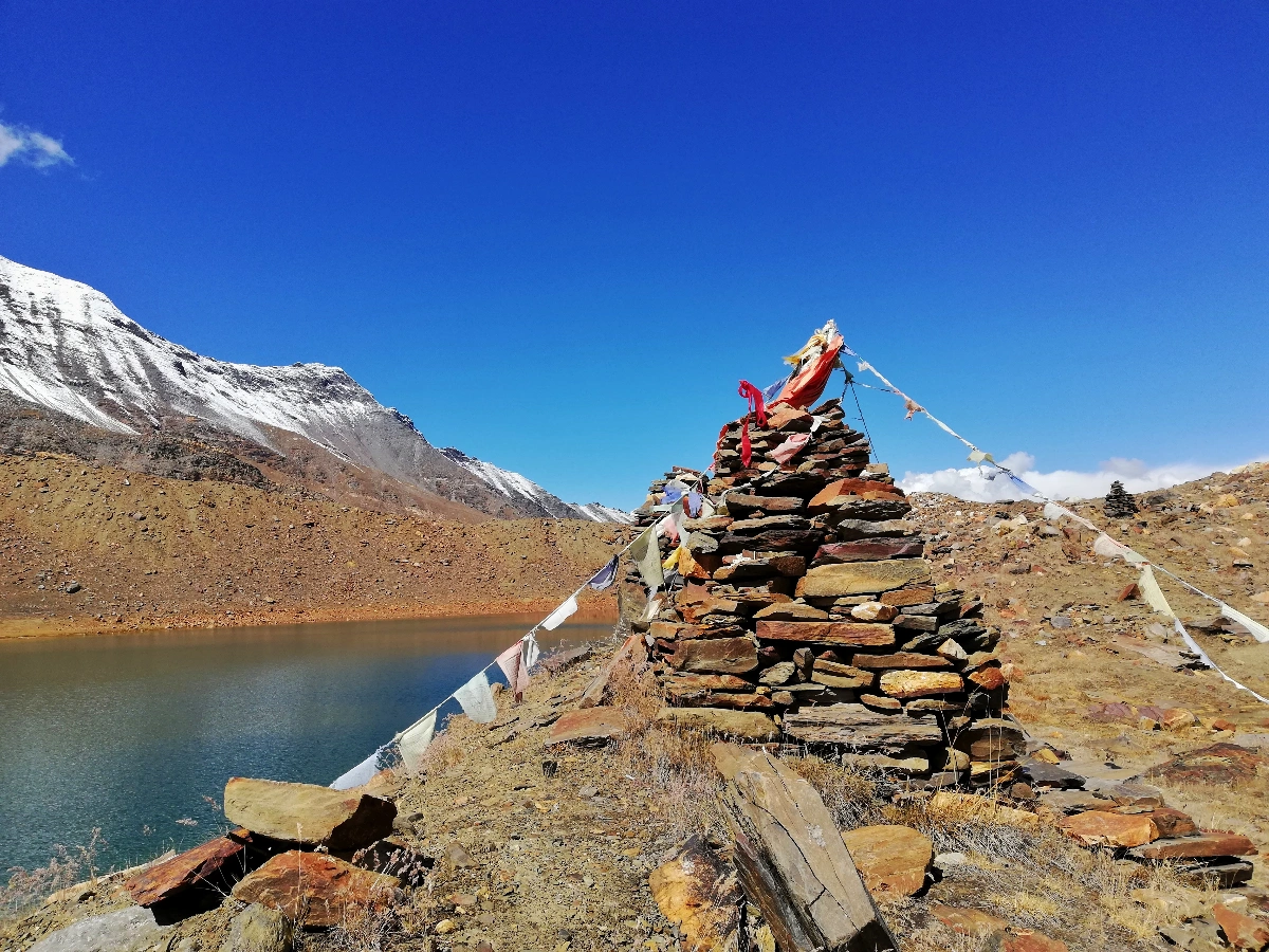
Lake view from Gaumukh Tapovan Trek
Gaumukh Tapovan view with Client summit
Gaumukh Tapovan Trek
River View from Gaumukh Tapovan Trek
Lake View from Gaumukh Tapovan Trek
Landscape and Cloudy View from Gaumukh Tapovan Trek

Gaumukh Tapovan Trek FAQs

Common questions about Gaumukh Tapovan Trek package, weather, difficulty, camping, and more. Can’t find your answer? Contact us!

What is the Gaumukh Tapovan trek and why is it famous?

The Gaumukh Tapovan trek leads to Gaumukh, the snout of the Gangotri glacier and the traditional source of the River Ganga, and continues to Tapovan, a high-altitude meadow at 4,463 m directly beneath Shivling peak. It’s famous for combining deep spiritual significance with genuinely demanding, high-altitude Himalayan trekking.

It’s rated Difficult. The trek covers 45 km over 8 days, reaching a maximum altitude of 4,463 m, and includes sustained glacial moraine crossings on Day 4 and Day 6 that are considerably harder than standard trail walking. Prior Himalayan trekking experience is strongly recommended.

May-June and September-October are the two operating windows. Monsoon (July-August) is avoided due to landslide risk and increased glacial melt hazards. The route is closed November through April due to heavy snow and avalanche risk at this altitude.

Tapovan sits at 4,463 m (14,642 ft), the trek’s highest point, reached on Day 4. This is significantly higher than Dayara Bugyal (3,408 m) or Surya Top (3,930 m), and altitude sickness is a genuine consideration on this route.

Gangotri is approximately 290 km from Dehradun — a 10-11 hour drive via Uttarkashi, following the Bhagirathi River valley. All Mountainiax packages include this transport. The nearest airport is Jolly Grant Airport, Dehradun.

Yes — the route runs through Gangotri National Park, and a forest entry permit is mandatory, arranged by our team as part of registration. Foreign nationals should confirm current Inner Line Permit requirements with us in advance, given the route’s proximity to the India-China border region.

No — this is not recommended as a first Himalayan trek. Given the altitude, moraine terrain, and sustained 8-day effort, we recommend at least one prior moderate-to-difficult Himalayan trek before attempting this route. Beginners are better served starting with our Dayara Bugyal or Kedarkantha treks.

Guesthouse accommodation in Gangotri on Day 1 and Day 7, with tent camping (sleeping bags and mats provided) at Chirbasa, Bhojbasa, and two nights at Tapovan.

Yes, for properly prepared and experienced trekkers, with certified high-altitude guides, oxygen support, and a built-in acclimatization day at Tapovan. It carries meaningfully more altitude and terrain risk than our beginner-grade treks, and thorough pre-trek medical disclosure matters more here than on any other trek we run.

Sturdy waterproof trekking shoes with ankle support, 4-5 warm layers including a proper insulated jacket, trekking poles (recommended, not optional, given the moraine terrain), gaiters, a 50-60L backpack, water purification tablets, and a comprehensive medical kit. A full checklist is shared with confirmed trekkers.

We recommend being able to comfortably walk 12-15 km on uneven, varied terrain, or run 5-6 km in under 30 minutes, along with at least one prior multi-day Himalayan trek completed, before attempting this route.

Yes, but Inner Line Permit requirements apply given the route’s proximity to the India-China border, and these can take longer to process than standard permits. Contact us well in advance of your intended dates to confirm current requirements.

Call or WhatsApp us at +91-6398937502 — we’re happy to help you plan.

STILL HAVE QUESTIONS?

Ready to walk to the source of the Ganga?

Call us at +91 6398937502 or send us a WhatsApp — we're happy to help you plan.