
- ★ Uttarakhand · Kumaon Himalayas
Kuari Pass Trek
- Walk Lord Curzon's old trail to a balcony seat above Nanda Devi.
- Book Now —₹14,500 + 5% GST per person, all-inclusive
- Six days from Rishikesh into a 12,516 ft ridge on the historic Lord Curzon Trail — dense oak and rhododendron forest, wide-open bugyals, and one of the largest concentrations of 7,000m+ peaks visible from any single viewpoint in Garhwal: Nanda Devi, Dronagiri, Chaukhamba, Kamet, Trishul and the Pancha-Chuli group.
- 4.8/5 Rating
- Running since 2018
- Certified Trek Leaders
- 24/7 Support
12,516 ft
Max Altitude Kuari Pass
21.5 km
Trek Distance 4 trekking days
6 DAYS
Duration 5 nights
Difficulty
Moderate
YEAR-ROUND
March–June, September–December (peak snow: Dec–Feb)
AGE 10+
Group Size Small batches
- The Curzon Trail
Kuari Pass Trek Overview
The first time I stood at Kuari Pass, I wasn’t looking at Nanda Devi. I was looking at my own breath, hanging in the air at minus four degrees, while our guide pointed a gloved hand past it and said “wait.” Thirty seconds later the cloud shifted and there she was — Nanda Devi, then Kamet, then Dronagiri, then Trishul, lined up across the horizon like they’d been waiting for their cue. That pause, right before the peaks show themselves, is the whole Kuari Pass trek in miniature. It makes you wait through oak forest and open ridgeline, and then it hands you one of the widest Himalayan panoramas you’ll get anywhere in Garhwal without technical climbing gear.
The Kuari Pass trek starts from the small road-head village of Dhak, a short drive from Joshimath in Chamoli district, and climbs through a genuinely varied landscape — thick oak and rhododendron forest low down, open bugyals (meadows) higher up, and finally a rocky, wind-scoured pass at over 12,500 feet. It’s often called the Curzon Trail, after Lord George Curzon, Viceroy of India, who trekked this same route in 1905 while scouting a road link between the Garhwal valleys. You’re walking a route that’s been used by shepherds, army reconnaissance parties, and curious Britishers for well over a century, and there’s something grounding about that history when you’re catching your breath on a switchback.
| Quick Facts | |
|---|---|
| Duration | 6 Days / 5 Nights |
| Trek Distance | ~28 km (Dhak to Kuari Pass, round trip) |
| Max Altitude | 12,516 ft (3,815 m) |
| Difficulty | Moderate |
| Base Village | Joshimath |
| Distance from Dehradun | 250 to 255 km (8–9 hour drive) |
| Best Time | MAR–JUN · SEP–DEC |
| Trek Price | ₹14,500 + 5% GST (all-inclusive) |
| Minimum Age | 10+ years |
This is a trek for the person who wants Himalayan scale without Himalayan commitment. At a moderate grade over six days, it suits a reasonably fit first-timer who has done some hill walking, as much as it suits an experienced trekker looking for a quick, high-reward winter outing. What makes it different from a lot of the popular Uttarakhand treks — Kedarkantha, Dayara Bugyal, Har Ki Dun — is the sheer density of 6,000–7,000-metre peaks visible from one pass. On a clear day at Kuari, you’re not squinting at one distant summit; you’re getting a 180-degree wall of them, with Nanda Devi (7,816 m), India’s second-highest peak, dominating the eastern skyline.
The rhythm of the trek is gentle and builds slowly. The first two trekking days move through forest, gaining altitude steadily but never brutally. Day three usually brings you above the tree line into meadows, and by day four you’re pushing for the pass itself — an early, cold start that rewards you before the clouds build up around midday, which they often do in the Himalayas. Descent days move quicker, retracing ridgelines with the peaks now behind you instead of ahead, which somehow makes you notice the forest itself more the second time through.
What kind of trekker does this suit? Honestly, a wide range. If you can walk five to six hours a day on uneven ground with a daypack, carry a bit of cold-weather discomfort with good humour, and don’t mind camping in temperatures that drop well below freezing in winter, you’ll be fine here. It’s not a trek that demands prior high-altitude experience, but it does reward basic fitness — some weeks of regular walking or cardio before you come. Families with older, fit teenagers do this trek; so do solo trekkers who want a short, high-impact winter escape from Delhi or Dehradun. What you won’t find here is technical climbing, glacier crossing, or genuinely committing terrain — Kuari Pass is a walking trek from start to finish, with the reward stacked almost entirely at the top.
- On This Page
- Kuari Pass Trek Overview
- What I Like / What to Know
- Best Time to Trek Kuari Pass
- Weather & Temperature
- How Difficult Is the Kuari Pass Trek
- Safety & Acclimatization
- How to Reach Kuari Pass (Joshimath / Dhak)
- Kuari Pass Camping and Trek Experience
- Day-Wise Itinerary
- What to Pack for Kuari Pass Trek
- Kuari Pass Trek Photography
- Flora, Fauna and the Ecosystem
- Pricing & Inclusions
- Kuari Pass Trek Gallery
- Kuari Pass Trek FAQs
- Trail notes
What I Like / What to Know
- 01
The panorama
The peak view is unusually generous. Most treks give you one dominant summit and a few supporting names. Kuari Pass gives you a full row — Nanda Devi, Nanda Ghunti, Kamet, Dronagiri, Hathi Parvat, Gauri Parbat, Trishul, Neelkanth, Chaukhamba — visible in a single sweep on a clear day. I’ve done treks with better single-peak views, but I haven’t done many with a wider spread of 6,000-plus-metre summits from one standing point.
- 02
The forest
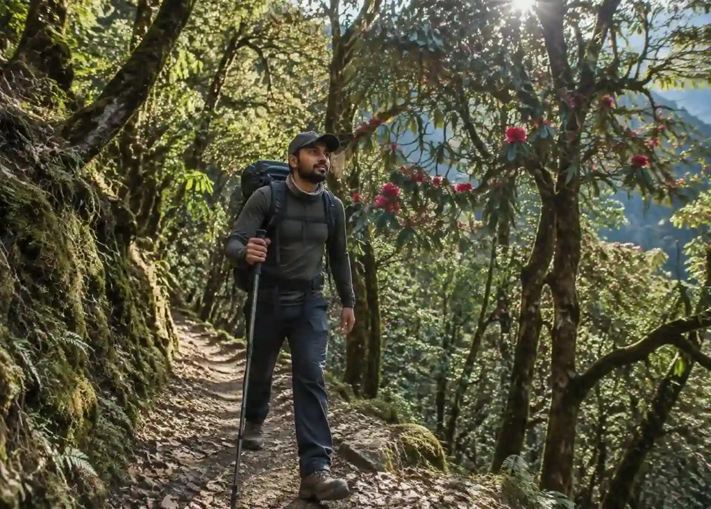
The forest sections are genuinely beautiful, not filler. The trail from Dhak to Gulling runs through mixed oak, rhododendron, and deodar forest that’s dense enough to block the sun in places. In April, the rhododendrons turn sections of the trail a deep, almost aggressive red — it’s one of the better rhododendron stretches I’ve walked in Garhwal, arguably better than the more famous ones on the Kedarkantha approach.
- 03
A true winter route
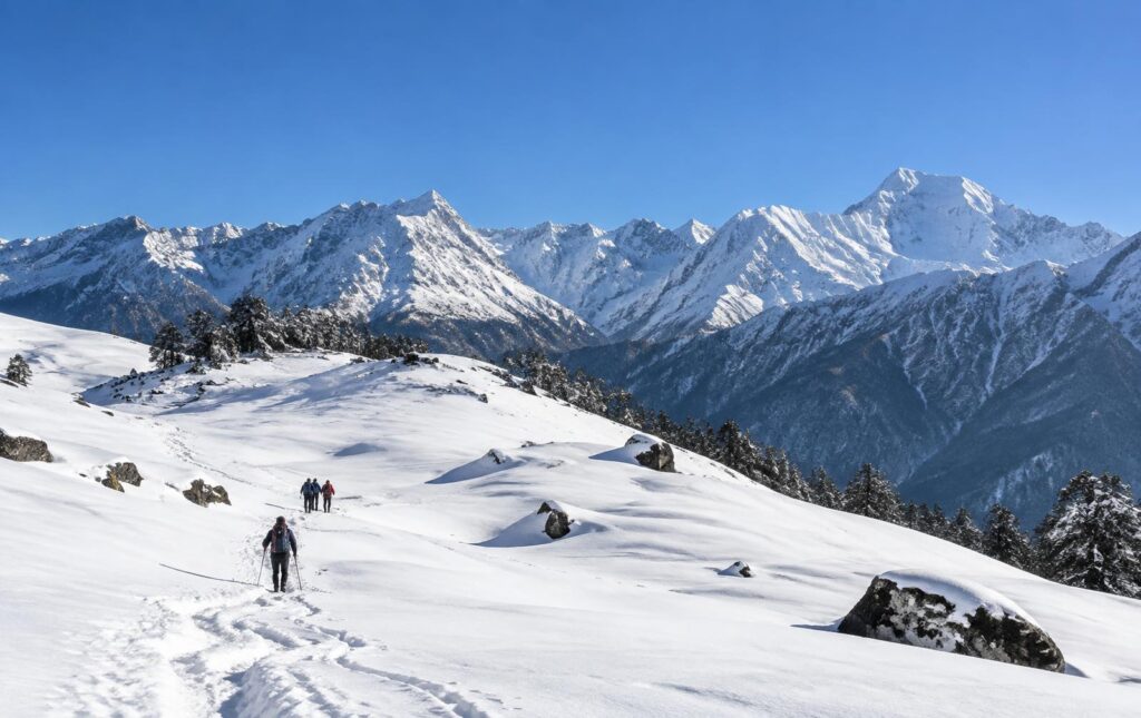
It’s a genuine winter trek, which most Uttarakhand treks aren’t. A lot of the popular treks close down or become technical in deep winter. Kuari Pass stays open and, honestly, is at its best under snow — the meadows turn into rolling white bowls and the pass itself becomes a proper winter mountaineering-style outing without needing technical gear.
- 04
The history
The Lord Curzon history adds something most treks don’t have. It’s a small thing, but walking a documented 1905 route rather than a generic “scenic trail” gives the trek a sense of place. Guides who know the history will point out where the old route diverges from the modern one.
- 05
Progressive camping
Base camp choice affects your experience more than people expect. Some operators run this trek from Joshimath directly with day drives to the trailhead; others camp progressively from Dhak onward. The progressive-camping version, where you carry through to Gulling, Khullara, and the pass camp without repeated drive-ins, gives you a much better acclimatisation curve and a quieter trail — fewer day-trippers, more genuine wilderness camping.
Pro tip
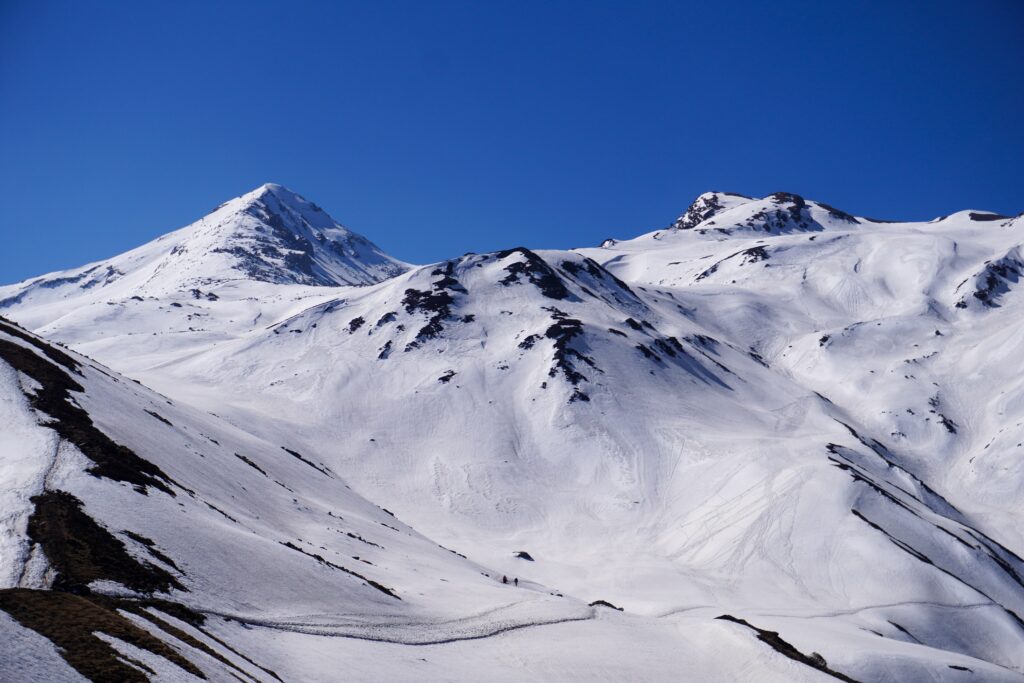
Get to the pass before 9 am. Cloud tends to build over the high peaks from mid-morning onward in the Garhwal Himalayas, especially outside the peak winter window. Leave camp before sunrise on summit day even though it’s brutally cold — it’s the single biggest factor in whether you get the clear view or a wall of grey.
Honest warning —
Summit day is cold in a way that catches people off guard. Even in October, pre-dawn temperatures at the high camp can drop to minus 5°C or colder; in peak winter you’re looking at minus 10°C to minus 15°C before sunrise. People who’ve only trekked in the monsoon months elsewhere in India consistently underestimate this. Bring real cold-weather gear, not “should be fine” gear.
Honest warning —
The ridge walk near the pass is exposed to wind. There’s no technical difficulty, but on a windy day the open ridge approaching Kuari Pass can be genuinely uncomfortable, even a little unnerving for first-timers, simply from wind chill and the drop-off on one side. It’s not dangerous with a competent guide, but it’s not a lazy stroll either.
Honest warning —
Network connectivity disappears fast. You’ll have signal in Joshimath and patchy signal in Dhak. Past Gulling, expect nothing until you’re back down. If you need to be reachable, tell people in advance and carry a basic list of emergency numbers rather than relying on your phone.
Honest warning —
Snow conditions change the difficulty rating meaningfully. A dry-trail October trek and a fresh-snow January trek on the same route are almost different experiences. Post-snowfall, trail-breaking through knee-deep snow on the approach to the pass adds real physical demand that the base “moderate” grading doesn’t fully capture. Ask your operator about recent snowfall before you commit to dates if you’re not confident on snow.
- Season planner
Best Time to Trek Kuari Pass
- Mid to late
September
The monsoon is tailing off and the trail is at its greenest, with meadows still lush from the rains. Visibility can be hit-or-miss in early September as residual monsoon cloud lingers, improving noticeably after the 20th. Daytime temperatures at camp sit around 12–15°C, nights around 2–5°C. Crowds are thin — this is a quiet-trail window for people who don’t mind occasional cloud in exchange for solitude and greenery.
Months to avoid
May through August is not recommended. Late May and June bring rising heat and haze that dulls the peak views considerably, while July and August fall in the monsoon, when the trail becomes slippery, leech-prone in the lower forest sections, and visibility drops to near zero on most days. Operators generally don’t run scheduled Kuari Pass batches through the core monsoon months.
Ideal months, in order
October and January are the two standout choices — October for the clearest post-monsoon skies with comfortable temperatures, January for the full snow-trek experience if you’re prepared for serious cold. November and April are close seconds, each trading a little of one extreme for more comfort.
- Best for clear skies
October
Widely considered one of the two best months. Post-monsoon skies are at their clearest, the forest is turning autumn colours, and the peaks are usually crisp and fully visible. Daytime temperatures hover around 10–14°C, dropping to 0 to minus 3°C at night, colder at the high camp. This is peak season, so expect more groups on the trail, especially over weekends.
Months to avoid
May through August is not recommended. Late May and June bring rising heat and haze that dulls the peak views considerably, while July and August fall in the monsoon, when the trail becomes slippery, leech-prone in the lower forest sections, and visibility drops to near zero on most days. Operators generally don’t run scheduled Kuari Pass batches through the core monsoon months.
Ideal months, in order
October and January are the two standout choices — October for the clearest post-monsoon skies with comfortable temperatures, January for the full snow-trek experience if you’re prepared for serious cold. November and April are close seconds, each trading a little of one extreme for more comfort.
- Cold and quiet
November
Cold and clear, with the first proper winter light on the peaks. Daytime is a pleasant 8–12°C in the sun, but nights drop sharply to minus 3 to minus 8°C. Light snow can dust the higher sections by late November in some years. Crowds thin out compared to October, making it a good compromise month — still excellent visibility, fewer people.
Months to avoid
May through August is not recommended. Late May and June bring rising heat and haze that dulls the peak views considerably, while July and August fall in the monsoon, when the trail becomes slippery, leech-prone in the lower forest sections, and visibility drops to near zero on most days. Operators generally don’t run scheduled Kuari Pass batches through the core monsoon months.
Ideal months, in order
October and January are the two standout choices — October for the clearest post-monsoon skies with comfortable temperatures, January for the full snow-trek experience if you’re prepared for serious cold. November and April are close seconds, each trading a little of one extreme for more comfort.
- Winter begins
December
Winter proper begins. Snow cover starts building on the upper trail and at the pass itself, turning the meadows white. Daytime temperatures are 3–7°C in direct sun, falling to minus 8 to minus 12°C at night. This is where Kuari Pass starts to feel like a genuine winter trek — snow boots and gaiters become necessary, not optional.
Months to avoid
May through August is not recommended. Late May and June bring rising heat and haze that dulls the peak views considerably, while July and August fall in the monsoon, when the trail becomes slippery, leech-prone in the lower forest sections, and visibility drops to near zero on most days. Operators generally don’t run scheduled Kuari Pass batches through the core monsoon months.
Ideal months, in order
October and January are the two standout choices — October for the clearest post-monsoon skies with comfortable temperatures, January for the full snow-trek experience if you’re prepared for serious cold. November and April are close seconds, each trading a little of one extreme for more comfort.
- Winter beginsBest for deep snow
January
The coldest, snowiest month, and for many repeat trekkers, the most beautiful. Fresh snow regularly covers the trail from Gulling upward, and the pass itself is a full white bowl. Daytime temperatures rarely exceed 3–5°C even in sun; nights fall to minus 10 to minus 15°C. This month demands the most from your gear and your cold tolerance, but rewards you with a trek that looks nothing like the same route in October.
Months to avoid
May through August is not recommended. Late May and June bring rising heat and haze that dulls the peak views considerably, while July and August fall in the monsoon, when the trail becomes slippery, leech-prone in the lower forest sections, and visibility drops to near zero on most days. Operators generally don’t run scheduled Kuari Pass batches through the core monsoon months.
Ideal months, in order
October and January are the two standout choices — October for the clearest post-monsoon skies with comfortable temperatures, January for the full snow-trek experience if you’re prepared for serious cold. November and April are close seconds, each trading a little of one extreme for more comfort.
- Deep snow
February
Similar conditions to January — deep snow, hard cold, spectacular views on clear days. Trail-breaking after fresh snowfall can be tiring, and some operators build in a buffer day for exactly this reason. Daytime 4–7°C, nights minus 8 to minus 12°C.
Months to avoid
May through August is not recommended. Late May and June bring rising heat and haze that dulls the peak views considerably, while July and August fall in the monsoon, when the trail becomes slippery, leech-prone in the lower forest sections, and visibility drops to near zero on most days. Operators generally don’t run scheduled Kuari Pass batches through the core monsoon months.
Ideal months, in order
October and January are the two standout choices — October for the clearest post-monsoon skies with comfortable temperatures, January for the full snow-trek experience if you’re prepared for serious cold. November and April are close seconds, each trading a little of one extreme for more comfort.
- Deep snowWinter transition
March
Snow begins to soften and recede at lower altitudes while still holding at the pass. This is a transition month — some years give you clean winter conditions into early March, others see early melt and slushy trail sections. Daytime warms to 8–12°C, nights minus 4 to minus 8°C. A good option for trekkers who want snow without the deepest winter cold.
Months to avoid
May through August is not recommended. Late May and June bring rising heat and haze that dulls the peak views considerably, while July and August fall in the monsoon, when the trail becomes slippery, leech-prone in the lower forest sections, and visibility drops to near zero on most days. Operators generally don’t run scheduled Kuari Pass batches through the core monsoon months.
Ideal months, in order
October and January are the two standout choices — October for the clearest post-monsoon skies with comfortable temperatures, January for the full snow-trek experience if you’re prepared for serious cold. November and April are close seconds, each trading a little of one extreme for more comfort.
- Rhododendron season
April
The rhododendron forest comes alive, and the trail dries out at lower elevations while the pass itself may still hold late-season snow patches. Daytime temperatures are a comfortable 12–16°C, nights 0 to minus 3°C. This is the second recommended window — better forest colour than October, slightly less reliable peak visibility due to afternoon haze building earlier in the year.
Months to avoid
May through August is not recommended. Late May and June bring rising heat and haze that dulls the peak views considerably, while July and August fall in the monsoon, when the trail becomes slippery, leech-prone in the lower forest sections, and visibility drops to near zero on most days. Operators generally don’t run scheduled Kuari Pass batches through the core monsoon months.
Ideal months, in order
October and January are the two standout choices — October for the clearest post-monsoon skies with comfortable temperatures, January for the full snow-trek experience if you’re prepared for serious cold. November and April are close seconds, each trading a little of one extreme for more comfort.
- Conditions
Weather & Temperature
Spring
- Mar–Apr
Day
8–16°C
Night
−4 to 0°C
Melting snow at lower altitude, rhododendrons blooming in April
Autumn
- Sep–Nov
Day
8–15°C
Night
0 to −8°C
Clear skies, best visibility, dry trail, occasional early frost
Winter
- Dec–Feb
Day
3–7°C
Night
−8 to −15°C
Heavy snow cover above Gulling, fully white pass, coldest window
Monsoon
- Jun–Aug
Day
15–20°C
Night
8–12°C
Not recommended — rain, leeches, poor visibility
Weather on Kuari Pass changes character sharply with altitude, more than most first-timers expect. At Joshimath (6,150 ft) and Dhak, you’re still in a relatively mild mid-hill climate; by the time you reach Gulling (around 9,200 ft) the temperature drop is noticeable even in a single day’s trek. Above Khullara, heading toward the pass at over 12,500 feet, wind chill becomes the dominant factor — actual air temperature can read a manageable minus 5°C, but a 20–30 km/h ridge wind makes it feel closer to minus 15°C. This is why summit-day gear matters more than trail-day gear on this particular route: you can be comfortable in a fleece at camp and still need a proper down jacket and windproof shell an hour later on the ridge. Snowfall, when it happens, tends to arrive as sudden afternoon systems in winter months, which is part of why guides push for early starts and early returns to camp.
- Moderate grade
How Difficult Is the Kuari Pass Trek
Kuari Pass sits solidly in the moderate category, and here’s the actual reasoning rather than just the label. Over six days, you’re covering roughly 28 kilometres with a total ascent of around 6,300 feet from Dhak (roughly 6,600 ft) to the pass (12,516 ft), spread across three real trekking-and-climbing days rather than compressed into one brutal push. Daily trekking time runs 4 to 6 hours on most days, stretching to 7–8 hours on summit day when you factor in the early start, the push to the pass, and the return to camp.
Day-by-day, the terrain builds logically. The Dhak-to-Gulling day is a sustained forest ascent — steady gradient, no technical sections, but enough continuous uphill to test unconditioned legs. Gulling to Khullara continues the climb through thinning forest into open meadow, with the gradient easing in places and steepening in short bursts. Summit day — Khullara to Kuari Pass and back — is where the trek earns its “moderate” rather than “easy” rating: a long, cold, high-altitude push with real elevation gain in a single day, on trail that can be snow-covered and requires basic winter walking competence (kicking steps, using trekking poles for balance, sometimes microspikes in icy sections). There’s no technical climbing, no rope work, no exposed scrambling — it’s entirely a walking trek — but the combination of altitude, cold, and sustained ascent on summit day is genuinely demanding for someone with zero hill-walking background.
For training, I’d recommend at minimum four to six weeks of regular cardio — brisk walking, jogging, or stair climbing, 30–45 minutes, four times a week — plus a few long walks of 2–3 hours on your feet to condition your legs for consecutive trekking days. You don’t need gym-level strength training, but you do need cardiovascular base fitness; this trek punishes unfit lungs more than it punishes weak legs.
Compared to Kedarkantha, a similarly popular winter trek, Kuari Pass is marginally longer and involves a bigger single-day altitude gain to its highest point, but has a gentler overall gradient profile — Kedarkantha’s summit push is shorter but steeper. Compared to a genuinely difficult trek like Roopkund, Kuari Pass is considerably easier — no glacier walking, no extended high-altitude camping, no real risk of altitude sickness at its 12,516 ft ceiling for most reasonably fit trekkers. If you’ve done Kedarkantha or Dayara Bugyal and found them manageable, Kuari Pass is a sensible next step; if you’re a genuine first-timer with decent fitness, it’s still an achievable, well-paced introduction to a proper Himalayan winter trek.
- Guide-led mountain care
Safety & Acclimatization
- Certified guides, pulse oximeter checks, gradual ascent and a clear descent protocol.
At a maximum altitude of 12,516 feet, Kuari Pass carries a real but manageable altitude risk — well below the danger zone of treks that push past 15,000–16,000 feet, but high enough that mild acute mountain sickness (AMS) symptoms — headache, mild nausea, unusual fatigue, disturbed sleep — do occur, particularly in trekkers who’ve flown or driven up from sea level in a single day without prior time in the hills. The itinerary is structured with a gradual altitude gain over the trekking days specifically to reduce this risk, and the night in Joshimath (6,150 ft) before trekking begins serves as a first acclimatisation buffer.
We travel with certified, trek-experienced guides who carry a first-aid kit, a pulse oximeter to monitor blood oxygen levels at camp, and are trained to recognise early AMS symptoms and manage the standard response — rest, hydration, paracetamol for headaches, and descent if symptoms worsen rather than improve. Trekkers are briefed on staying well-hydrated (3–4 litres of water a day at altitude), avoiding alcohol during the trek, and reporting symptoms early rather than pushing through them.
The specific risk points on this trail are the exposed, windy ridge approaching Kuari Pass itself — manageable with a competent guide and appropriate pacing, but not a place to rush or wander from the group — and post-snowfall sections above Khullara, where trail visibility can be poor and a guide’s route knowledge matters. In deep winter, microspikes and trekking poles are standard issue for the summit push.
Emergency evacuation on this route is realistic compared to more remote Himalayan treks: Joshimath, with road access and basic medical facilities, is never more than one to two days’ walk from any point on the trail, and mobile network — though absent on the higher trail sections — returns once you’re back near Dhak or Joshimath. Serious cases are evacuated by a combination of porter-assisted descent and road transport from the nearest accessible point; in genuine emergencies, helicopter evacuation can be arranged from Joshimath, which has a helipad used for Char Dham and disaster-response operations. General safety practice on the trek includes a daily briefing, a buddy system on exposed sections, mandatory basic insurance, and a hard rule that no one summits or continues past a point where a guide assesses conditions as unsafe.
- Getting there
How to Reach Kuari Pass (Joshimath / Dhak)
Nearest railway station
Rishikesh and Haridwar are the practical rail heads, both roughly 250–290 km from Joshimath by road. Haridwar has better long-distance rail connectivity from major cities.
Nearest airport
Jolly Grant Airport, Dehradun, is the nearest airport, around 280–300 km from Joshimath (roughly the same drive distance as starting from Dehradun city).
Local transport
From Joshimath, it’s a short 15–20 km drive to Dhak village, the actual trailhead, taking about 45 minutes on a narrow hill road. This last stretch is typically covered by shared jeep or the trek operator’s own vehicle rather than public transport, since bus frequency to Dhak is limited.
Suggested travel-day plan
If you’re coming from outside Uttarakhand, build in a buffer day. Reach Rishikesh or Dehradun a day before the trek’s official start date, rest overnight, and join the group’s Day 1 drive to Joshimath fresh rather than arriving already travel-fatigued. This single buffer day meaningfully reduces the odds of starting the trek exhausted, which in turn reduces AMS risk on the first trekking day.
From Dehradun
Joshimath is roughly 280–290 km from Dehradun, a drive of about 10–11 hours on hill roads via Rishikesh, Devprayag, Srinagar (Garhwal), Rudraprayag, Karnaprayag, and Chamoli. This route passes through several of the Panchprayag river confluences, which makes for one of the more scenic long drives in Uttarakhand rather than a dull transit day. Given the length, most operators, including Mountainiax, start this drive early — around 6:00–6:30 am — to arrive in Joshimath by evening with enough daylight margin for road conditions in the hills.
From Delhi
Add roughly 6 hours to Dehradun’s drive time and around 250 km, since you first need to reach Rishikesh or Haridwar before joining the same mountain road. Realistically, this makes a same-day Delhi-to-Joshimath drive punishing — closer to 15–16 hours total. Most trekkers from Delhi either take an overnight train or early flight to Dehradun/Haridwar and start the Joshimath leg fresh the next morning, or set out from Delhi in the very early hours (before 4 am) to reach Joshimath by night.
- On the Mountain
Kuari Pass Camping and Trek Experience
Camping on the Kuari Pass trail has a rhythm of its own. Your first night at Gulling is inside a forest clearing — tents pitched under oak cover, a common dining tent where the whole group eats together, and a campfire most evenings if forest conditions allow it. It’s the kind of camp that still feels connected to the world below: birdsong in the morning, a stream nearby for washing up.
By the time you reach Khullara, the character changes completely. You’re camping right at the meadow’s edge, tents facing an open horizon that’s slowly filling up with peaks. There’s no campfire warmth to rely on here — the cold sets in fast once the sun drops, and this is where your sleeping bag and thermal layers actually get tested.
What to expect:
- Twin/triple-sharing tents with sleeping bags and mats provided
- A common kitchen and dining tent — meals served hot, usually a simple vegetarian menu (dal, rice, sabzi, chapati, soup to start)
- Bio-toilets set up at each campsite, tents pitched a short walk from the sleeping area
- Drinking water sourced from streams near camp, purified before serving
- Camp routine: early dinner, a briefing for the next day, lights out by 8–9 pm since summit day starts before sunrise
The camping experience here is more about earning your comfort than being pampered — you’ll appreciate a hot cup of tea at Khullara far more than you would at sea level. That contrast is part of what makes the trek memorable.
- Six-day route
Day-Wise Itinerary
1
DAY
- Rishikesh / Dehradun to Joshimath
- Drive: ~280 km
- Duration: 9–11 hours
- Altitude: 1,150 ft → 6,150 ft
This is a long day, but not a wasted one. Leaving Rishikesh in the early morning light, the road follows the Ganga and then the Alaknanda, climbing steadily past Devprayag — where the Bhagirathi and Alaknanda physically merge into the Ganga, a sight worth the window seat — through Srinagar, Rudraprayag, and Karnaprayag, each town marking another river confluence, another prayag. The road itself narrows and starts genuinely climbing after Rudraprayag, with hairpin bends and valley drops that make the last three hours the most dramatic of the drive. By late afternoon you’ll start seeing snow-capped ridgelines ahead — your first real signal that Joshimath, and the mountains proper, are close. You’ll check into a guesthouse in Joshimath for the night, use the evening for a final gear check and trek briefing, and get an early night, because tomorrow is when the actual walking starts.
2
DAY
- Joshimath/Dhak to Gulling Camp
- Drive: 15 km (45 min) | Trek: 5–6 km
- Duration: 4–5 hours
- Altitude: 6,150 ft → 6,890 ft (Dhak) → 9,186 ft (Gulling)
A short jeep ride from Joshimath drops you at Dhak, a small road-head village that marks the true start of the trek. The trail leaves the road and climbs immediately into mixed oak and rhododendron forest — this is the section that turns brilliant red in April, though it’s a deep, textured green the rest of the year. The gradient is steady rather than steep, a genuine warm-up climb through forest thick enough that you lose the road and the village behind you within twenty minutes. Roughly halfway, the trail passes a couple of small clearings where shepherds sometimes graze goats, and you’ll likely hear more birdsong here than at any other point on the trek — this lower forest belt is noticeably alive compared to the starker terrain higher up. Gulling itself is a forest clearing campsite, ringed by trees but with the canopy opening just enough to catch your first real glimpse of distant snow peaks through the branches. Water at Gulling comes from a nearby stream and is reliably good; camp fires are usually permitted here, weather and forest-department rules depending, and it’s a genuinely pleasant first night out.
3
DAY
- Gulling to Khullara
- Trek: ~4–5 km
- Duration: 3–4 hours
- Altitude Gain: ~2,000 ft | Altitude: 9,186 ft → ~11,000 ft
The forest starts thinning noticeably today, oak and rhododendron giving way gradually to more open coniferous stands and then, in the final stretch, proper high-altitude meadow. This is, for me, the day where the trek’s real character shows up — the views open dramatically over a short distance, and you go from walking inside a forest to walking across a rolling green (or white, in winter) bugyal with a genuine sense of exposure and scale. Khullara sits right at the edge of this meadow zone, and camping here on a clear evening, with the peaks starting to line up along the horizon as the sun drops, is one of the quieter highlights of the trek — less dramatic than the pass itself, but arguably more peaceful. The climb to get here is shorter than Day 2 but noticeably steeper in patches, and altitude starts to genuinely register for most trekkers today: a slightly heavier pack, shorter breath on the steeper pitches. This is also the day guides watch most closely for early AMS symptoms, given the altitude jump.
4
DAY
- Khullara to Kuari Pass and Back
- Trek: ~8–9 km round trip
- Duration: 7–8 hours
- Altitude Gain: ~1,500 ft | Altitude: 11,000 ft → 12,516 ft → back to Khullara/Tali
Summit day starts in the dark, headlamps on, well before sunrise — the earlier start you make, the better your odds of a clear pass before afternoon cloud builds. The trail climbs out of Khullara along an increasingly open ridge, tree cover falling away almost completely within the first hour, replaced by wide views that keep expanding with every switchback. This is the most physically demanding stretch of the whole trek: sustained climbing at altitude, often on snow or frozen ground depending on season, with a cold wind that rarely lets up on the exposed sections. The final approach to the pass is a broad, rocky-to-snowy saddle rather than a sharp summit, and the reward, when the weather cooperates, is close to 180 degrees of major Himalayan peaks — Nanda Devi and Nanda Ghunti to the east, Kamet, Dronagiri, Hathi Parvat and Gauri Parbat further along, Trishul and Chaukhamba visible on a genuinely clear day. Most groups spend 30–45 minutes at the pass — enough time for photos, a hot drink from a flask, and a proper look, before the cold and the risk of building cloud push everyone back down. The descent to camp retraces the same ridge, faster than the ascent but still demanding on tired legs, and camp that evening — whether back at Khullara or a shifted camp closer to Tali — feels thoroughly earned.
5
DAY
- Descent to Dhak / Auli Visit and Drive to Joshimath
- Trek: ~6–7 km | Drive: 15 km
- Duration: 4–5 hours trek + drive
- Altitude: ~11,000 ft → 6,890 ft (Dhak) → 6,150 ft (Joshimath)
The trail back down retraces the ascent route in reverse, through the meadow belt and back into forest, but it reads completely differently in this direction — you’re facing the valley and the receding peaks rather than climbing toward them, and it’s a good day to actually notice the forest itself, the details you were too breathless to register on Day 2. It’s a genuinely quick descent compared to the climb, gravity doing most of the work, and most groups reach Dhak by early-to-mid afternoon. From there it’s a short drive back to Joshimath, and depending on timing and group energy, an optional evening visit to Auli — India’s best-known ski resort, connected by cable car, and worth the short detour for one more wide-angle mountain view before you leave the region, this time from a completely different vantage point.
6
DAY
- Joshimath to Rishikesh / Dehradun
- Drive: ~280 km
- Duration: 9–11 hours
The long drive back down the same route — Chamoli, Karnaprayag, Rudraprayag, Srinagar, Devprayag, and finally Rishikesh — with an early start to reach Dehradun or Rishikesh by evening. It’s a quiet day by trek standards, mostly spent watching the valleys widen and the temperature climb back toward normal, with plenty of time on the drive to trade photos and trail stories with the rest of the group before everyone heads their separate ways.
- Gear checklist
What to Pack for Kuari Pass Trek
What should I carry on the Kuari Pass Trek? A practical layering system, sturdy waterproof shoes, and a few Himalayan-specific essentials — here’s the full breakdown by category.
Clothing
- 3–4 thermal base layers (upper and lower) — non-negotiable given night temperatures well below freezing in winter
- Fleece or light down midlayer jacket
- Heavy down jacket (rated for at least minus 10°C) for winter batches
- Windproof, water-resistant outer shell jacket
- Waterproof/windproof trek pants
- 3–4 pairs of trekking socks, plus 1–2 pairs of warm woollen socks for camp
- Woollen cap covering ears, plus a separate sun cap for daytime trekking
- Balaclava or neck gaiter for summit-day wind
- Fleece or wool gloves, plus a waterproof outer glove shell for winter batches
Footwear
- Broken-in, ankle-high trekking shoes with good grip — do not bring brand-new boots
- Gaiters (essential for winter/snow batches to keep snow out of boots)
- Camp shoes or sandals for evenings
Optional but recommended
- Microspikes, if trekking in peak winter (December–February) and your operator doesn't provide them
- A lightweight thermos flask for hot water/drinks on summit day
- Trekking gaiters-compatible gloves liner for photography without fully removing outer gloves
- A basic camera or good phone case, since the pass views are worth capturing properly
Essentials
- 60–70 litre rucksack with rain cover, or a duffel plus daypack if you're using porter/mule support
- Trekking poles (strongly recommended, especially for the descent and summit day)
- Headlamp with spare batteries (essential for the pre-dawn summit start)
- 2-litre water bottle or hydration bladder
- Sunglasses with UV protection (snow glare at altitude is genuinely damaging without them)
- Sunscreen (SPF 40+) and lip balm with SPF
- Personal first-aid kit and any personal medication
- Power bank, since charging points disappear after Joshimath
Documents
- Original + photocopy of a government photo ID
- Recent medical fitness certificate (most operators, including Mountainiax, require this for altitude treks)
- Any pre-arranged trek insurance documentation
A full, printable checklist is shared with every confirmed trekker before their batch date.
Gear You Can Rent Instead of Buying
If this is your first Himalayan trek and you’re not ready to invest in a full kit, several items are worth renting rather than buying outright — a good insulated jacket, trekking poles, and gaiters in particular tend to sit unused in a cupboard after a single trip if you’re not a frequent trekker. Talk to us before your batch date and we can point you to trusted rental options in Dehradun, or let you know which items we can arrange directly.
A Note on What Not to Overpack
First-time trekkers tend to overpack in two specific ways: too many clothing changes (you will re-wear things — that’s normal on a multi-day trek) and too much “just in case” gear that adds weight without adding much real utility. A loaded backpack that’s 2-3 kg lighter than it needs to be makes a genuinely noticeable difference by Day 4. If you’re offloading your bag (see the camping section above), this matters less, but if you’re carrying your own pack, it’s worth a second, more critical look at your pile before you zip it shut.
- Light and Life
Kuari Pass Trek Photography
Kuari Pass rewards photographers more than most Uttarakhand treks, mainly because of how much sky and peak real estate you get in a single frame from the pass itself.
Best photography moments:
- 01
Sunrise from Khullara
the meadow catches first light before the peaks do; a good spot for silhouettes and warm-toned wide shots
- 02
The pass itself, 30–45 minutes after arrival
as the sun climbs, shadows on Nanda Devi and Dronagiri shift fast, so don’t wait too long to shoot your main frames
- 03
The rhododendron forest in April
deep red blooms against dark green canopy, especially strong on the Dhak-to-Gulling stretch
- 04
Winter batches (Dec–Feb)
the meadows turn into rolling white bowls; overcast light here actually works better than harsh sun for texture shots
Practical tips:
- Batteries drain fast in the cold — keep spares inside your inner jacket pocket, not your backpack
- A polarizing filter helps cut glare off snow at altitude
- Carry a basic phone case or dry pouch — condensation is a real problem moving between warm tents and freezing mornings
- If you're using a proper camera, get to the pass early — cloud building from mid-morning is the single biggest reason people miss their shot
- Ecology
Flora, Fauna and the Ecosystem
The Kuari Pass trail cuts through a genuine altitude gradient, and the vegetation shifts noticeably as you climb. Lower down, the trail winds through dense forests of oak and rhododendron, with plenty of shade and a rich understory. As the altitude increases, the forest gradually becomes thinner and more open, giving way to alpine meadows, scattered shrubs, and eventually a much more exposed mountain landscape. The changing vegetation makes the climb feel like a gradual transition through several distinct Himalayan environments rather than simply a walk uphill.
Lower forest (Dhak to Gulling, 6,900–9,200 ft):
Mixed oak, rhododendron, and deodar forest dominate here. Rhododendron arboreum (the tree form, not the shrub) turns sections of the trail a deep red through March–April. This belt also has the most birdlife on the trek — expect to hear (and sometimes spot) Himalayan whistling thrush, various woodpeckers, and Kalij pheasant in the undergrowth.
Mid-altitude transition (Gulling to Khullara, 9,200–11,000 ft):
Oak gives way to coniferous stands — blue pine and fir — before opening into meadow. This is also where dwarf rhododendron shrubs appear, a different species from the tree-form lower down, hugging the ground and blooming later in the season.
High-altitude bugyal and pass (11,000–12,516 ft):
Above the tree line, the landscape is alpine meadow and scree. Wildflowers carpet the bugyals through June–August (though this falls in the monsoon window when the trek isn’t typically run), and in winter the same ground is under snow.
Wildlife
The route passes through the buffer zone near the Nanda Devi Biosphere Reserve, so sightings of Himalayan musk deer, Himalayan griffon vultures overhead, and occasionally Himalayan tahr on higher slopes are possible, though not guaranteed. Leopard and Himalayan black bear are present in the region but rarely encountered on the main trail.
A note on conservation:
This is protected forest and buffer-zone terrain. Guides ask trekkers not to pick flowers, feed wildlife, or stray off marked trails, both for ecosystem protection and personal safety.
- For Families
Kuari Pass Trek with Kids — Is It Suitable for Families?
Short answer: yes, with some real caveats.
Kuari Pass is graded moderate, and the minimum age we accept is 10 years, provided the child has some hill-walking or general fitness background — this isn’t a trek to bring a first-time-ever hiker on, regardless of age.
Our recommendation: For families with kids in the 10–14 age range, we suggest the October or April batches specifically — milder temperatures, drier trail, and a more forgiving margin if the child needs a slower pace. We’re happy to discuss your child’s fitness and trekking history before you book; a quick call with our team helps set the right expectations.
What makes it workable for families:
- The daily trekking distances (4–6 hours on most days) are manageable for a fit, older child
- Forest sections on Days 2–3 are gentle enough to enjoy rather than endure
- The reward at the pass is dramatic enough to make the effort worthwhile for a younger trekker
What parents should know before booking:
- Summit day (Day 4) is long, cold, and starts before sunrise — genuinely demanding even for fit adults, more so for a child
- Winter batches (Dec–Feb) involve serious cold, often below −10°C at night — not recommended for younger children even if they meet the age minimum
- There's no partial-itinerary option — if a child isn't managing well by Khullara, descent options are limited compared to lower-altitude treks
- Trek package
Pricing & Inclusions
Our Kuari Pass Trek package is priced at ₹14,500 + 5% GST, all-inclusive, for the full 6 days / 5 nights.
Book Your Kuari Pass Trek Now — ₹14,500What's Included
- Accommodation on a twin/triple-sharing basis (guesthouse in Joshimath, tented camps on the trail)
- All meals from dinner on Day 1 to breakfast on Day 6 (vegetarian, trail-appropriate menu)
- Trekking permits and forest entry fees
- Services of a certified trek leader and support guides
- Camping equipment — tents, sleeping bags/mats, common kitchen and dining tents
- First-aid kit, oxygen cylinder, and pulse oximeter carried on the trek
- Mule/porter support for common camping equipment
What's Not Included
- Transport to and from Rishikesh/Dehradun (unless a pickup package is specifically booked)
- Personal trekking gear (see packing list above)
- Personal expenses — snacks, beverages, tips for guides and support staff
- Trek insurance (available as an add-on if not already held)
- Any costs arising from early descent, medical evacuation, or extended stay due to weather or personal reasons
- GST as applicable
Upcoming Batches
We run regular departures through spring and summer, with dedicated winter batches from December through March. Current availability and exact dates are listed on the booking section above — batches do fill up, particularly the May-June wildflower window and the December-January winter skiing dates, so booking 3-4 weeks ahead is a reasonable rule of thumb.
Kuari Pass Trek Gallery
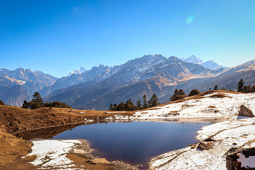
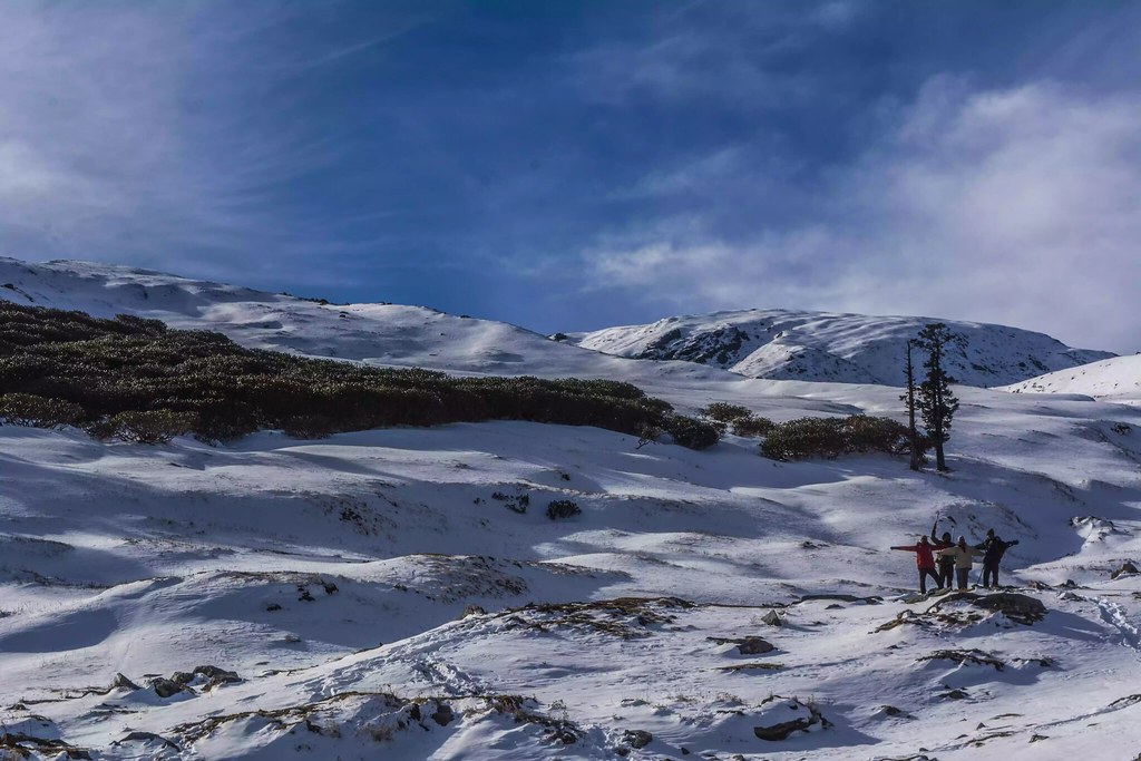
Where endless alpine meadows meet the mighty Himalayas — moments from the Kuari Pass Trek
- Answers
Kuari Pass Trek FAQs
Common questions about Kuari Pass Trek package, weather, difficulty, camping, and more. Can’t find your answer? Contact us!
How difficult is the Kuari Pass trek for a first-timer?
It’s graded moderate. If you can walk 5–6 hours a day on uneven ground and have done a few weeks of regular cardio beforehand, it’s achievable even as your first Himalayan trek. Summit day is the toughest single day — cold, early start, sustained climbing at altitude.
What is the best time to do the Kuari Pass trek?
October and January are the two standout months — October for clear post-monsoon skies and comfortable temperatures, January for the full snow-trek experience. November and April are close seconds.
Is there mobile network on the trek?
You’ll have signal in Joshimath and patchy signal in Dhak. Past Gulling, expect no network until you’re back down.
Do I need prior trekking experience?
No prior high-altitude experience is required, but basic fitness (regular cardio for 4–6 weeks before the trek) is strongly recommended.
Is Kuari Pass suitable for children?
Yes, with a minimum age of 10 and some prior hill-walking experience. Winter batches are not recommended for younger children due to extreme cold.
What is the trek price and what does it include?
₹14,500 + 5% GST, all-inclusive of accommodation, meals, permits, camping equipment, and trek leader/guide services. Transport to/from Rishikesh or Dehradun is not included unless a pickup package is booked separately.
What is the trek price and what does it include?
₹14,500 + 5% GST, all-inclusive of accommodation, meals, permits, camping equipment, and trek leader/guide services. Transport to/from Rishikesh or Dehradun is not included unless a pickup package is booked separately.
Can I rent trekking gear instead of buying it?
Yes — items like down jackets, trekking poles, and gaiters can be rented. Contact our team before your batch date for rental options in Dehradun
Is there a risk of altitude sickness (AMS)?
There’s a real but manageable risk at this altitude. Our trek leaders carry pulse oximeters and are trained to recognise and manage early AMS symptoms. The itinerary is paced specifically to reduce this risk.
What happens if the weather turns bad on summit day?
Your trek leader has the final call on whether it’s safe to push for the pass. Safety takes priority over the itinerary — if conditions are unsafe, the group may wait a day or turn back.
Can I fly a drone on this trek?
Check current forest department regulations before your batch — drone rules in this region change periodically and permissions aren’t guaranteed.