
- Uttarakhand · Garhwal Himalayas
Chopta Tungnath Chandrashila Trek
- with Deoriatal
- Book Now — ₹6,500/- per person onwards
- Walk to the world's highest Shiva temple and watch the sun rise over the Garhwal Himalayas.
- 4.8/5 Rating
- 1000+ Trekkers
- Certified Guides
- 24/7 Support
3,980 m
Max Elevation Chandrashila
26–28 km
Distance Total trek
4N / 5D
Duration Rishikesh–Rishikesh
Easy–Moderate
Difficulty Beginner friendly
Mar–Jun · Sep–Dec
Best Months Year-round trek
Up to 20
Group Size Small batches
- About the Trek
Why the Chopta Tungnath Chandrashila Trek is Uttarakhand's most complete Himalayan experience
If you could design one Himalayan trek to hand a first-timer as proof of what the mountains are capable of, it would look a lot like the Chopta Tungnath Chandrashila trek. In four nights and five days, you get a mirror-still alpine lake, a thousand-year-old temple standing at the edge of the sky, a summit that shows off half the Garhwal skyline in one sweep, and forest trails so quiet you can hear your own footsteps change rhythm with the altitude.
The trek begins at Sari village, a small settlement tucked into the folds of the Kedarnath Wildlife Sanctuary in Rudraprayag district, and threads together four separate destinations that most trekkers spend years trying to visit one at a time: Deoriatal, Chopta, Tungnath Temple, and the Chandrashila summit. Each has its own character. Deoriatal is contemplative — a lake so still it duplicates the entire Chaukhamba massif on its surface. Chopta is the meadow you never want to leave, often nicknamed the “Mini Switzerland of India.” Tungnath is sacred ground, the highest Shiva temple on the planet at 3,470 m and the third stop on the Panch Kedar pilgrimage circuit. And Chandrashila, at 3,980 m, is the payoff — a 360-degree amphitheatre of snow peaks that includes Nanda Devi, Trishul, Chaukhamba, Kedar Dome, and Bandarpunch, best seen at first light when the sky turns the colour of embers.
What makes this trek genuinely special isn’t just the individual stops — it’s how accessible the whole experience is. You don’t need mountaineering experience, specialised gear, or weeks of training. You need reasonable fitness, warm layers, and five days. That combination — spiritual depth, visual drama, and low barrier to entry — is exactly why the Chopta Tungnath Chandrashila trek consistently ranks among the most-searched and most-booked treks in Uttarakhand, and why it works equally well for a solo first-timer, a family with older kids, or a group of friends looking for a long weekend that actually feels like an adventure.
Unlike many Himalayan treks that shut down for eight months of the year, this one is walkable in every season, each with a completely different personality — rhododendron-red in spring, monsoon-green in July (though we don’t recommend this window), crystal-clear in autumn, and snow-blanketed in winter. Few treks in India offer that kind of year-round versatility while still delivering a genuine high-altitude payoff above 3,900 metres.
| Quick Facts | |
|---|---|
| Duration | 5 Days / 4 Nights (4 trekking days) |
| Trek Distance | 26-28 km |
| Max Altitude | 3,980 m |
| Difficulty | Easy – Moderate |
| Base Village | Sari Village |
| Distance from Dehradun | 246 km (7 hour drive) |
| Best Time | May–June, September–October |
| Trek Price | ₹6,500 + 5% GST (all-inclusive) |
| Minimum Age | 8 years |
Chopta itself sits roughly 450 km from Delhi and around 190–200 km from Rishikesh, making it a realistic long-weekend trip from North India without the multi-day approach that treks further into the interior Himalayas demand.
- On This Page
- About theChopta Tungnath Chandrashila Trek
- What you'll actually experience on the trail
- Things to know before you go
- An honest, section-by-section breakdown
- The mythology behind the trail — Pandavas, Panch Kedar, and Tungnath
- A practical 3-week fitness training plan
- Your 4-night, 5-day journey
- A trek for all four seasons — each with its own personality
- How to reach the base camp
- Things to carry — full checklist
- Accommodation and meals
- Inclusions and exclusions
- Simple, transparent pricing
- Cancellation and refund policy
- Chopta Tungnath Chandrashila vs other Panch Kedar treks
- Sari Village and Garhwali homestay life
- Kedarnath Wildlife Sanctuary — the ecology under your feet
- Tips for the Chandrashila sunrise shot
- Chopta Tungnath Chandrashila Trek Gallery
- FAQ's
- The Four Pillars
What you'll actually experience on the trail
01
Deoriatal — The Lake That Mirrors the Mountains
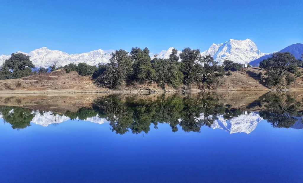
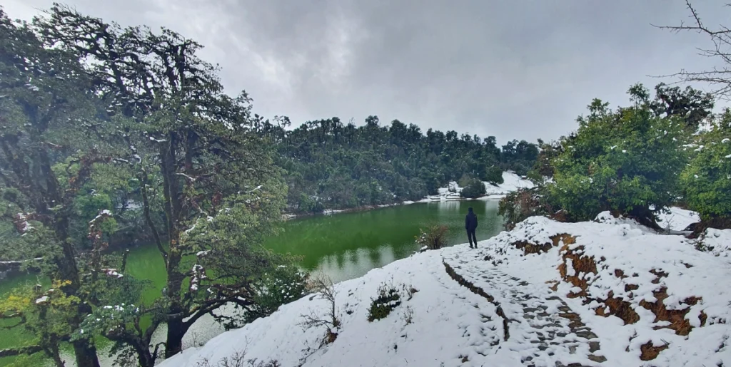
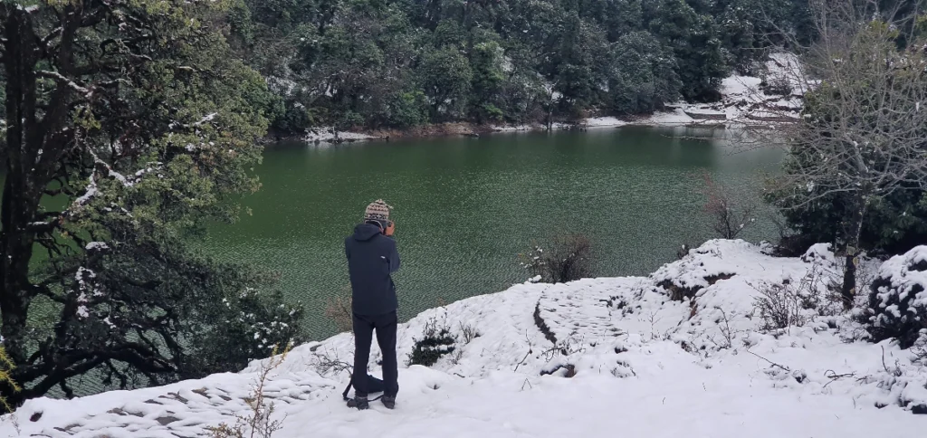
Deoriatal sits at approximately 2,438 m, about 3 km of uphill walking from Sari village through dense oak, rhododendron, and ringal bamboo forest. It’s a small lake by Himalayan standards, but its stillness is what makes it famous — on a clear morning, the entire Chaukhamba massif (6,995 m) reflects on the water with almost no distortion, a scene that photographers plan entire trips around.
The lake also carries genuine mythological weight. It appears in the Mahabharata, where the Pandavas are said to have rested by its banks, and it’s associated with a well-known story in which Yudhishthira faces a divine test at the water’s edge. Locals still refer to it with quiet reverence rather than as a tourist stop, and camping beside it — watching the color drain from the sky and the stars take over — is one of the most talked-about nights of the entire trek.
02
Chopta — The Meadow Everyone Calls "Mini Switzerland"
At 2,680 m, Chopta is less a village than a long, open meadow flanked by oak, deodar, and rhododendron forest, with a scattering of dhabas and guesthouses that exist almost entirely to serve trekkers. It’s the base camp for the push to Tungnath and Chandrashila, but it’s also a destination in its own right — the kind of place where people linger over a second cup of tea just to keep watching the light change on the peaks.
The “Mini Switzerland of India” nickname gets thrown around loosely in Indian trekking marketing, but Chopta earns it more than most — rolling green meadows, dark conifer forest, and a wall of snow peaks on the horizon, all without needing binoculars.
03
Tungnath Temple — Lord of the Peaks
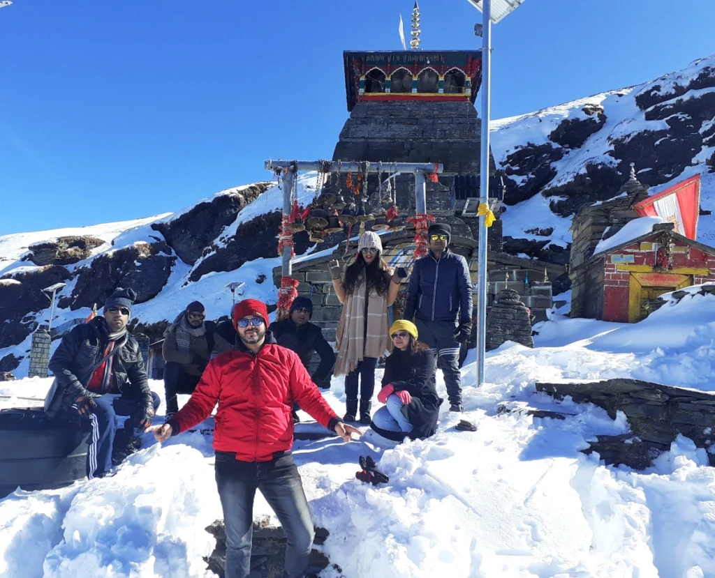
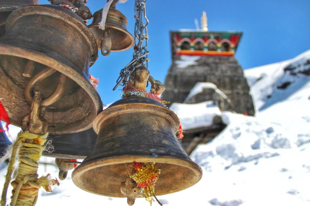
Tungnath means “Lord of the Peaks,” and at 3,470 m it holds the title of the highest Shiva temple in the world. It’s the third stop on the sacred Panch Kedar circuit — the group of five Shiva temples that also includes Kedarnath, Madmaheshwar, Rudranath, and Kalpeshwar — and local legend holds that it was built by the Pandavas themselves, on the spot where Lord Shiva’s arms are said to have appeared after the Mahabharata war.
The temple itself is a modest stone structure, over a thousand years old by most accounts, standing in a landscape so exposed and elevated that reaching it already feels like an accomplishment before you’ve even continued to the summit. From the temple courtyard, the view opens up across Chaukhamba, Bandarpunch, Nilkantha, and Kedar Dome — a preview of what’s waiting a little further up the trail.
Note: Tungnath Temple closes for winter (the deity is ceremonially moved to Mukkumath village), typically from November to April/May, but the trek itself remains open and walkable year-round, including as a striking winter snow trek.
04
Chandrashila Summit — Moon Rock, and the Best Sunrise in Garhwal
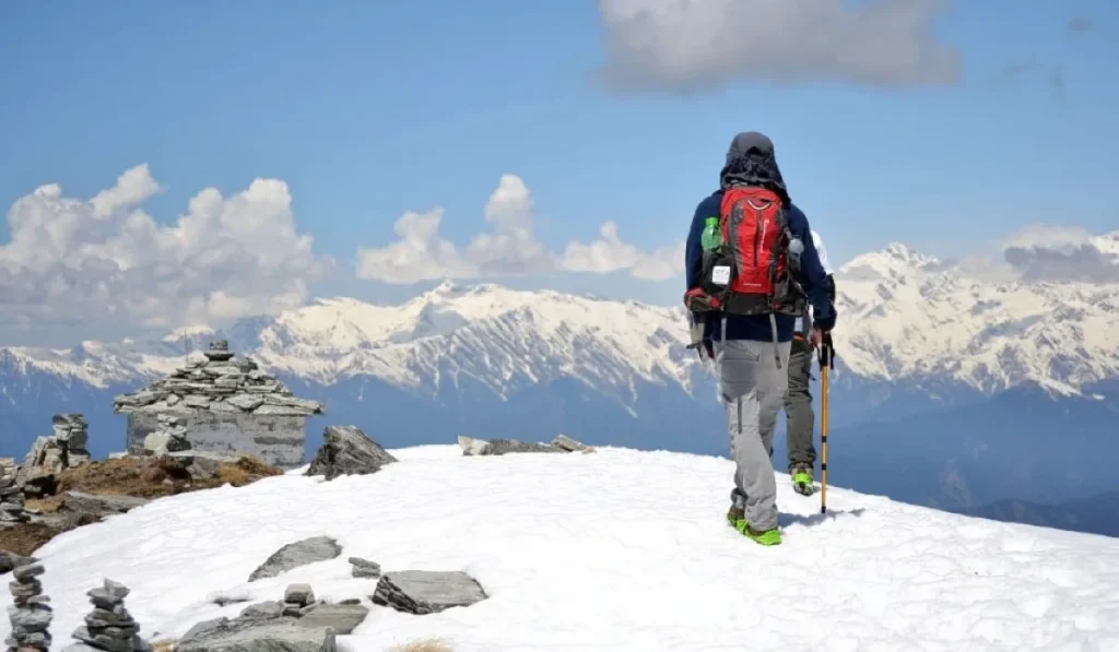
Chandrashila translates to “Moon Rock,” and at 3,980 m it’s the literal and emotional high point of the trek. The final 1.5 km push from Tungnath is short but genuinely demanding — thinner air, a steeper natural trail, and a real sense of exposure as the landscape drops away on either side.
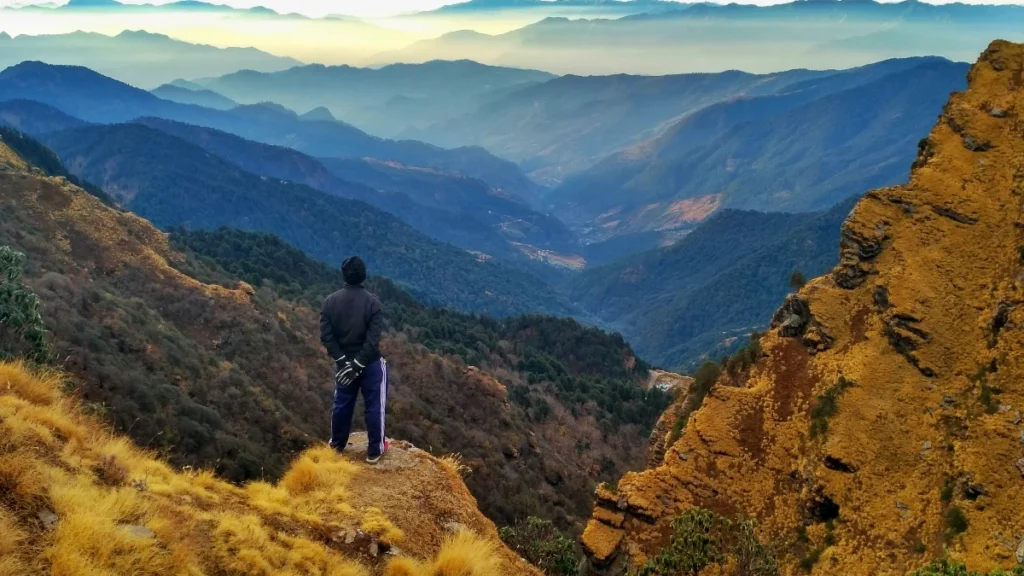
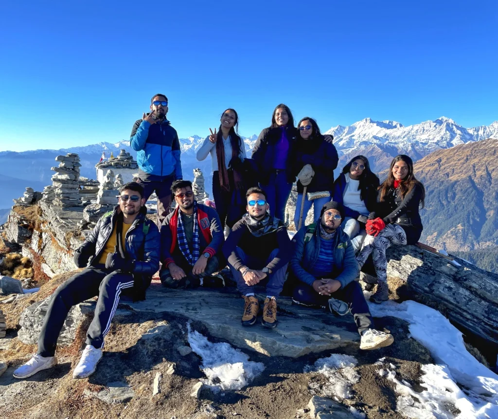
What you get in return is one of the most complete 360-degree Himalayan panoramas accessible without technical climbing: Nanda Devi (7,816 m, India’s second-highest peak), Trishul, Chaukhamba, Kedar Dome, Bandarpunch, Nilkantha, and the wider Gangotri group, all visible from a single standing point. Trekkers who time their summit push for pre-dawn are rewarded with a sunrise that lights up this entire skyline in shades of gold and crimson — widely regarded as one of the finest sunrise points in the Garhwal Himalayas, and the single most photographed moment of the trek. A small Shiva shrine at the summit adds a quiet devotional note to what is otherwise a purely scenic high point.
- Quick Facts
Things to know before you go
- Difficulty
An honest, section-by-section breakdown
This is one of the most searched questions before booking, and it deserves a straight answer rather than a marketing one.
- Overall Grade
Easy to Moderate
The trail is well-defined throughout, stone-paved in several sections, and involves no technical climbing, rope work, or glacier crossing. That said, “easy” doesn’t mean effortless — you’re gaining real altitude, the daily trekking hours add up, and the final summit push happens above 3,900 m.
Section 1: Sari to Deoriatal
- 3 km · +438 m ascent · Moderate
A steady, moderately steep uphill climb through dense forest cover, typically taking 1.5–2 hours. The trail is clear, well-worn, and shaded for most of the way. Rated Moderate mainly because of the sustained gradient rather than technical difficulty.
Section 2: Deoriatal to Baniyakund / Chopta approach
- Variable · via Tala village and Rohini Bugyal
This is the connecting stretch that many shorter itineraries skip but that adds genuine trekking distance and meadow scenery — rolling bugyal (alpine meadow) terrain, gentle ridge walking, and forest sections.
Section 3: Chopta to Tungnath Temple
- 3.5–4 km · +790 m ascent · Moderate
The main event of the trek for most people. The trail is stone-paved for the majority of its length with a steady, manageable gradient that steepens noticeably in the final 500 m. Most trekkers cover this in 2–3 hours.
Section 4: Tungnath to Chandrashila Summit
- 1.5 km · +510 m ascent · Moderate to Challenging
Short on paper, tough in practice. The stone steps give way to a natural, sometimes loose trail, and the thin air at nearly 4,000 m means your breathing rate climbs faster than the trail does. 45–60 minutes from Tungnath — this is the section where fitness actually matters.
Fitness Requirements
You don’t need to be an athlete, but you should be comfortably able to walk 8–10 km on varied terrain and climb stairs continuously for 30–40 minutes without stopping to catch your breath. If you’re starting from a sedentary baseline, two to three weeks of daily brisk 45-minute walks or light jogging, plus some stair-climbing or a few sessions of basic cardio, will make a real difference on summit day. Trekkers who arrive undertrained don’t usually fail to complete the trek — they just enjoy it a lot less.
Altitude Consideration
At 3,980 m, Chandrashila is high enough that mild symptoms of altitude adjustment — a slight headache, faster breathing, reduced appetite — are common and normal, not a sign that something has gone wrong. The itinerary is structured with gradual elevation gain and an acclimatization-friendly pace precisely to reduce this risk, but it’s worth knowing your body’s response to altitude in advance if you’ve had issues on previous high-altitude trips. Staying hydrated, avoiding alcohol during the trek, and pacing yourself on the final ascent are the three simplest things you can do to make the summit day comfortable.
- Legend & History
The mythology behind the trail — Pandavas, Panch Kedar, and Tungnath
Part of what makes this trek different from a purely scenic hike is that almost every stop along the way carries a story that’s been told for centuries, and knowing them changes how the landscape feels underfoot.
The Pandavas and the Search for Shiva
The mythology tying this entire route together goes back to the aftermath of the Kurukshetra war in the Mahabharata. Having killed their own kin — cousins, teachers, and elders — during the war, the Pandava brothers sought Lord Shiva’s forgiveness to absolve themselves of the sin of fratricide and Brahmanahatya. Shiva, the story goes, was reluctant to grant this absolution and fled from the Pandavas repeatedly, taking the form of a bull and eventually diving into the ground near present-day Guptkashi to avoid them.
According to local legend, as the Pandavas pursued him, parts of Shiva’s body are said to have reappeared at five different locations across the Garhwal Himalayas — and each site became a temple. The hump appeared at Kedarnath, the arms at Tungnath, the face at Rudranath, the navel and stomach at Madmaheshwar, and the hair (or “jata”) at Kalpeshwar. Together, these five temples form the Panch Kedar — literally “five Kedars” — one of the most significant pilgrim circuits in the Shaivite tradition, and Tungnath’s position as the site of Shiva’s arms is precisely why it’s considered such sacred ground, despite being smaller and less visited than Kedarnath itself.
Why Tungnath Specifically
Local tradition holds that the temple at Tungnath was built by the Pandavas themselves, making it — by legend — one of the oldest of the five, alongside being the highest. Architecturally, the temple reflects a style common to early Himalayan temple construction: modest stone masonry, a simple sloped roof designed to shed heavy snow, and an interior sanctum that feels deliberately unadorned compared to the grandeur of plains temples. That simplicity is part of its character — this is a temple built for a place where survival, not spectacle, shaped every design decision.
Deoriatal and the Yaksha Prashna
Deoriatal carries its own separate mythological weight, tied to a different, equally famous episode from the Mahabharata — the “Yaksha Prashna,” or the Yaksha’s Questions. In the story, the Pandavas, thirsty during their exile, send each brother in turn to fetch water from a lake guarded by a Yaksha (a nature spirit), who demands that his questions be answered correctly before anyone may drink. Four of the five brothers ignore the warning and die attempting to drink without answering. Only Yudhishthira, the eldest, pauses to answer the Yaksha’s philosophical questions correctly, and in doing so not only saves himself but revives his brothers. While several lakes across North India lay claim to being the actual site of this legend, Deoriatal is among the most commonly cited locations in regional Garhwali tradition, and locals will often recount the story unprompted if you ask about the lake’s name.
Why This Context Matters on the Trail
None of this is required knowledge to enjoy the trek — but it changes the texture of the walk. Reaching Tungnath isn’t just arriving at a scenic high point; it’s arriving at a site that pilgrims have specifically sought out for over a thousand years as one-fifth of a sacred, deliberately scattered whole. Standing at Chandrashila afterward, having completed the push past the temple, carries a small echo of that older pilgrim logic — the summit as both a physical and symbolic completion of the climb.
- Preparation
A practical 3-week fitness training plan
Given how frequently “is this trek hard” comes up before booking, it’s worth going a level deeper than a general fitness recommendation. Below is a simple, realistic 3-week preparation plan for trekkers coming from a mostly sedentary baseline. If you’re already active, treat this as a maintenance guide rather than a starting point.
Why Prepare At All for an "Easy to Moderate" Trek?
The trek’s overall grading as Easy to Moderate is accurate for the trail conditions — no technical climbing, no exposed scrambling, a mostly well-defined path. But grading doesn’t account for cumulative fatigue across multiple trekking days, or for how altitude above 3,500 m makes even a gentle gradient feel noticeably harder. Undertrained trekkers rarely fail to finish this route, but they consistently report enjoying the final summit push far less than trekkers who arrived with a baseline of cardio fitness. A small amount of preparation buys you a much better experience on the one day — Chandrashila summit day — that actually demands it.
- Week 1
Building a Base
- Brisk 30–40 minute walks, 4–5 days a week, ideally on any available incline
- Basic bodyweight strength work twice a week — squats, lunges, planks
- Light stretching daily — calves, hamstrings, hip flexors
- Week 2
Increasing Load
- Extend walks to 45–60 minutes with a loaded daypack (5–8 kg)
- Stair-climbing sessions — 15–20 minutes twice this week
- Continue strength work, increasing to 3 sets per exercise
- Week 3
Simulating Conditions
- One long walk/hike of 8–10 km on varied terrain in your trekking shoes
- Stair-climbing sessions of 25–30 minutes continuous
- Taper intensity in the final 3–4 days — prioritize rest and sleep
A Simple Fitness Benchmark
If you can comfortably walk 5 km in under 45 minutes and climb 3–4 flights of stairs without significant breathlessness, you’re at a solid baseline for this trek. If you’re well below that benchmark two weeks out, focus your remaining time on walking volume rather than trying to cram in strength training — cardiovascular endurance matters more than raw leg strength for a trek like this.
A Note on Age and Prior Conditions
Trekkers in their 40s, 50s, and beyond complete this trek regularly and without issue, provided general fitness is reasonable and any existing cardiac, respiratory, or joint conditions have been cleared by a doctor beforehand. If you have a pre-existing medical condition — particularly anything cardiac, respiratory (including asthma), or related to blood pressure — a pre-trek medical check-in is strongly recommended regardless of age, given the altitude involved.
- Detailed Itinerary
Your 4-night, 5-day journey
Download the full detailed itinerary as a PDF — link available on the booking page.
1
DAY
- Rishikesh to Sari Village (Base Camp)
- 🚗 ~200 km drive
- ⏱️ 7–8 hrs
Your journey begins at the Mountainiax pickup point in Rishikesh, from where the drive winds through Devprayag, Rudraprayag, and Ukhimath before climbing into the hills toward Sari village. The route itself is a gentle introduction to the trip — you pass the confluence of the Alaknanda and Bhagirathi rivers at Devprayag, catch glimpses of rural mountain life along the way, and watch the landscape steadily shift from the spiritual bustle of Rishikesh into quieter, greener terrain. By evening, you’ll arrive in Sari village, settle into a homestay or guesthouse, meet your trek team, and get a full briefing. Overnight stay in Sari.
2
DAY
- Sari to Deoriatal & onward toward Chopta/Baniyakund
- 🥾 ~3 km to Deoriatal, continuing onward
- ⏱️ Full day
An early start takes you on a steady 3 km uphill trek from Sari to Deoriatal lake, gaining roughly 400+ m through dense forest. The reward at the top is immediate — the emerald lake, ringed by rhododendron and ringal bamboo, with Chaukhamba reflected on its surface if the morning is clear. Spend time here for photographs and a break before the trail continues onward through rolling bugyal terrain and forest sections toward the next camp. Overnight in camp.
3
DAY
- Trek via Tala Village / Rohini Bugyal to Baniyakund
- 🥾 ~8–10 km
- ⏱️ 6–7 hrs
This is the longest and arguably most scenic walking day of the trek — open bugyal meadows, ridge-line views, and forest trail linking Deoriatal’s alpine setting to the Chopta side of the region. The terrain rolls rather than climbs sharply, making it a physically engaging but not brutal day. You’ll reach Baniyakund by evening, the last overnight stop before the drive to Chopta. Overnight in camp.
4
DAY
- Baniyakund → Chopta → Tungnath → Chandrashila Summit → Chopta
- 🚗 ~5 km
- 🥾 ~9–10 km round trip
- ⏱️ 8–10 hrs
- 📍 Max 3,980 m
The big day. A short drive takes you from Baniyakund to Chopta, from where the main ascent begins — a 3.5–4 km climb to Tungnath Temple, the highest Shiva temple in the world, followed by a further 1.5 km push to the Chandrashila summit at 3,980 m. At the top, weather permitting, you’ll get the full panoramic reward: Chaukhamba, Bandarpunch, Nilkantha, Trishul, Nanda Devi, and Kedar Dome laid out across the horizon. Spend time at the summit before descending back through Tungnath to Chopta for the night.
5
DAY
- Chopta to Rishikesh
- 🚗 ~200 km drive
- ⏱️ 8–9 hrs
After breakfast, begin the return drive from Chopta to Rishikesh, retracing the route through the Garhwal foothills. This is the natural point to reflect on the past four days — the lake, the temple, the summit sunrise — before re-entering the busier rhythm of Rishikesh by evening (typically 7:00–8:00 PM). The trek officially concludes here.
Detailed Itinerary
Click below to download the full detailed itinerary as PDF.
Day 1: Rishikesh to Sari Village (Base Camp)
Embark on your adventure from Rishikesh to Sari Village, the base camp for the Chopta Tungnath Chandrashila trek. The journey takes you through the heart of Uttarakhand — passing through Devprayag, Rudraprayag, and Ukhimath — transitioning from the bustling spiritual life of Rishikesh into the tranquil and majestic settings of the Himalayas. As you travel, the landscape gradually shifts, offering glimpses of rural mountain life and the natural beauty that characterizes this region. Reach Sari village by evening. Overnight stay in homestay/hotel.
- 🛣️ Distance: 200 km (Drive) ·
- ⏱️ Time: 7–8 hrs from Kathgodam
Day 2: Sari → Deoriatal → Chopta → Tungnath → Chandrashila Summit
Early morning trek from Sari to Deoriatal lake (3 km uphill) — a pristine emerald lake offering breathtaking reflections of Mount Chaukhamba. After spending time at the lake, descend back to Sari and drive to Chopta (approx 35 km). From Chopta, begin the steep but rewarding 3.5 km trek to Tungnath — the world’s highest Shiva temple at 3,470 m. Continue another 1.5 km ascent to Chandrashila summit (3,980 m) for jaw-dropping 360° views of Chaukhamba, Bandarpunch, Nilkantha, Trishul, Nanda Devi, and Kedar Dome. Descend back to Chopta. Overnight in camp/hotel.
- 🥾 Trek: ~12 km · 🛣️ Drive: ~35 km ·
- ⏱️ Time: 8–10 Hours
- 📍 Max Alt: 3,980 m
Day 3: Chopta to Rishikesh
After breakfast, depart from Chopta for the return journey to Rishikesh. This marks the end of your trekking adventure as you retrace the route back through the scenic landscapes of the Garhwal Himalayas. The drive back offers a final opportunity to reflect on the experiences and vistas of the past days. Expected arrival in Rishikesh by evening (approx 7:00–8:00 PM). Trek concludes with unforgettable memories.
- 🛣️ Distance: 200 km (Drive)
- ⏱️ Time: 8–9 Hours
- Best Time
A trek for all four seasons — each with its own personality
One of the biggest advantages of this trek is that it’s genuinely walkable through all four seasons — each with a distinct look and feel.
- Best for first-timers
Spring · Mar – Jun
Peak rhododendron season, with entire hillsides turning shades of red and pink. Weather is mild, trails are clear of snow and mud, and Himalayan views are crisp after the winter. April and May are the sweet spot; late May into June brings warmer days and occasional pre-monsoon cloud but remains beautiful.
- Not recommended
Monsoon · Jul – Aug
The valley turns a deep, saturated green, which is undeniably photogenic — but rain brings slippery trails, landslide risk on approach roads, leeches in the forest sections, and frequently clouded-over mountain views right when you want them most. Unless you’re an experienced trekker, this window is best avoided.
- Best for peak views
Autumn · Sep – Dec
Post-monsoon skies are at their clearest, air is crisp, and the Himalayan peaks appear almost unnaturally close. October is arguably the single best month on the entire route — golden forests, moderate crowds, and the sharpest possible panorama from Chandrashila. Extends comfortably into early December.
- Experienced trekkers
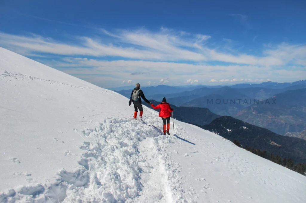
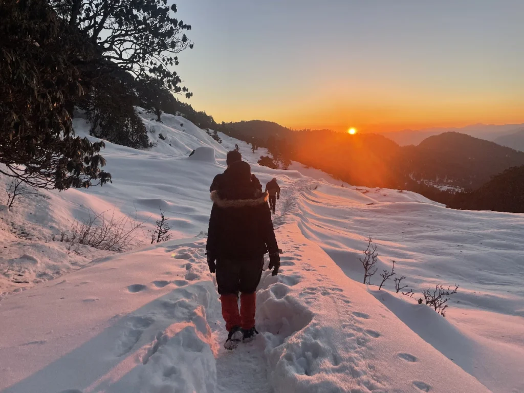
Winter · Dec – Feb
Post-monsoon skies are at their clearest, air is crisp, and the Himalayan peaks appear almost unnaturally close. October is arguably the single best month on the entire route — golden forests, moderate crowds, and the sharpest possible panorama from Chandrashila. Extends comfortably into early December.
- Getting There
How to reach the base camp
By Air
The nearest airport is Jolly Grant Airport, Dehradun, roughly 35 km from Rishikesh, with regular flights connecting to Delhi and other major cities. From the airport, a taxi to Rishikesh takes about an hour.
By Rail
Rishikesh Railway Station is the nearest and most convenient railhead, well-connected to Delhi, Haridwar, and other major North Indian cities. Haridwar Junction, about 25 km away, is a larger station with a wider range of connections.
By Road
Rishikesh is well connected by road to Delhi (approx. 240 km, 6–7 hours), Haridwar (25 km), and Dehradun (45 km). We strongly recommend arriving in Rishikesh a day before your trek start date, especially if flying in.
From Rishikesh onward: Mountainiax handles the entire onward journey — pickup from Natraj Chowk, Rishikesh, transport to Sari village (the actual base camp), and the return drop at the end of the trek. You don’t need to arrange any separate transport once you’ve reached Rishikesh.
- Packing List
Things to carry — full checklist
A well-packed bag is the difference between an enjoyable trek and a miserable one. Here’s what we recommend.
Basic Gear
- Backpack (50–60 L, with rain cover)
- Daypack (20–30 L, for summit day)
- Trekking shoes with ankle support and grip
- Trekking pole (at least one, strongly recommended)
- LED torch or headlamp with spare batteries
- Water bottle (1 L) or thermos flask
- Lunch box / small tiffin
- Basic personal medication
Clothing
- Trekking jacket (windproof/waterproof outer)
- Warm fleece or down layers
- Two trek pants (quick-dry, not denim)
- Full-sleeve dry-fit T-shirts
- Thermals (more if trekking in winter)
Accessories
- Sunglasses (UV-protected)
- Sunscreen (SPF 50/70)
- Lip balm (SPF 30)
- Synthetic hand gloves
- Woolen cap
- Three pairs of socks
- Raincoat or poncho (non-negotiable)
Others & Documents
- Plastic covers for wet clothes
- Original government photo ID (Aadhaar/Passport/DL/Voter)
- Photocopy of the same ID
- Small personal medical kit
- Power bank (no charging beyond Chopta)
- Stay & Meals
Accommodation and meals
Sari Village / Chopta (Day 1 and last night): Homestay or hotel accommodation, typically triple-sharing, giving you a genuine glimpse into local Garhwali hospitality before and after the trekking days.
On the trek (Deoriatal, Baniyakund, campsites): Comfortable, good-quality dome or A-shaped tents on triple-sharing basis, with clean sleeping bags and mats provided. Separate kitchen tents, common dining tents, and toilet tents are set up at each campsite by the support crew.
Meals: All meals are vegetarian, freshly cooked by the trek cook, and planned around the energy demands of high-altitude walking — starting from dinner on Day 1 through to breakfast on the final day. Hot tea, soup, and snacks are typically provided at camp to help with warmth and hydration.
- What's Covered
Inclusions and exclusions
What's Included
- Transport support from Rishikesh to Rishikesh.
- All vegetarian meals starting from dinner on day 1 to breakfast on the last day.
- Hotel accommodation in Sari/Chopta in triple sharing for first and last day.
- Triple sharing Tent accommodation throughout the trek.
- Professional guide, cook and support staff.
- Rent for camping equipment.
- Clean sleeping bags and mats.
- Good quality ¾ or 4 season 'A' shaped or dome tents.
- Kitchen tents, common tents, toilet tents.
- Forest entry charges for Indian nationals (non-Indian passport holders: additional charge).
- Porter and mule support to carry camping equipment (NOT personal luggage).
- All applicable taxes.
Not Included
- Personal expenses like tips, personal medicines, phone calls etc.
- Any transport support during the trek apart from what is included above.
- Any cost or services not mentioned in the Inclusions.
- Accommodation in Dehradun.
- Cost arising due to unforeseen incidents like bad weather, medical evacuation, road blocks etc.
- Porter/mule charges to carry personal luggage – Can be arranged at an additional cost of INR 500 per day (1 soft bag per person < 12 kg).
- Package Pricing
Simple, transparent pricing
- Policy
Cancellation and refund policy
Cancellation Policy
We understand that plans can change. If you need to cancel, reduce, or amend a guaranteed reservation, please do so by 12 noon, 15 days prior to arrival to avoid cancellation charges. Any cancellation made within 15 days of arrival will be 100% non-refundable. Bookings made under non-cancellable or non-amendable packages or rates cannot be canceled or amended, and the full amount of the advance paid will be treated as the cancellation fee. The same terms apply if guests do not show up.
For all bookings other than non-cancellable ones, if the guest does not show up, the complete booking will be non-refundable. If the guest chooses to check out early, one night’s room rate, including taxes, will be charged. No cancellations will be accepted over the phone or via WhatsApp message. Please reply to the email confirmation you received at the time of booking to request a cancellation.
No refunds will be provided in case of problems arising due to government orders, harsh weather conditions, protests, landslides, or other unforeseen circumstances. In such cases, we usually have a backup plan ready and will proceed with that. Sometimes, we may have to cancel activities mentioned in the itinerary due to circumstances beyond our control.
If a trek is called off at the last moment due to natural calamities or unforeseen circumstances (such as rain, snowfall, earthquake, landslides, strikes, or bandhs), participants will be provided with a travel voucher for the same amount. This voucher can be used within 365 days of the issuance date for any package of equal value, subject to availability.
If a trek or trip has to be aborted midway due to natural calamities or unforeseen circumstances, no refund will be provided. Mountainiax will not bear any extra expenses due to such natural calamities or unforeseen circumstances.
Refund Policy
The following refund shall be payable to the user in case of valid cancellation as per the guidelines:
Note: The above-mentioned refunds are subjected to deductions for any expenses that may have been incurred for hotel booking or transport etc. Refunds are applicable on the total cost and not on the advance amount.
- Compare
Chopta Tungnath Chandrashila vs other Panch Kedar treks
vs Kedarnath Trek
Kedarnath (3,583 m) is reached via a well-paved 16–18 km trail from Gaurikund — technically shorter than the full Chopta route, but far busier, especially during the Char Dham Yatra when tens of thousands of pilgrims walk the same path daily. Kedarnath is a pilgrimage first and a trek second. Chopta Tungnath Chandrashila, by contrast, is a genuine trekking experience — quieter trails, forest and meadow sections, and a true summit payoff at Chandrashila.
vs Madmaheshwar Trek
Madmaheshwar, the second Kedar, is reached via a longer, more remote trail from Ransi village — around 17 km one-way through much less-visited terrain. It’s a trek for people who’ve already done Chopta Tungnath Chandrashila and want something wilder, with fewer facilities. It doesn’t offer anything comparable to the Chandrashila summit panorama, but it scores higher on solitude.
vs Rudranath Trek
Rudranath, the third Kedar, is one of the more physically demanding treks in the region — a long, steep 20+ km approach through dense forest with limited camping infrastructure. Chopta Tungnath Chandrashila is significantly more accessible while still delivering the ‘sacred temple at altitude’ reward.
vs Deoriatal-Chandrashila-only (short) treks
The stripped-down 2N/3D version skips the Baniyakund/Tala village extension and goes straight from Sari to Deoriatal to Chopta. Legitimate if you’re tight on time, but it trades away 8–10 km of genuinely scenic bugyal meadow walking. If your schedule allows, the fuller 4N/5D itinerary is worth it — the difference between a highlights reel and the full film.
The Bottom Line
Among all five Panch Kedar-adjacent treks, Chopta Tungnath Chandrashila remains the single best entry point into high-altitude Uttarakhand trekking — short enough for a long weekend, easy enough for beginners, and rewarding enough that experienced trekkers still rate the Chandrashila sunrise among the best they’ve seen. It’s not the most remote, the most difficult, or the most exclusive trek in the region — and that’s precisely the point. It’s the one that consistently delivers.
- Flora & Fauna
Kedarnath Wildlife Sanctuary — the ecology under your feet
The Chopta Tungnath Chandrashila trek runs almost entirely through the Kedarnath Wildlife Sanctuary, one of the largest protected high-altitude ecological zones in Uttarakhand, spanning over 900 sq. km across Rudraprayag, Chamoli, and Uttarkashi districts. Trekking through a designated sanctuary changes the character of the walk — this isn’t just scenic forest, it’s a genuinely protected habitat.
Forest Cover
The lower stretches, particularly between Sari and Deoriatal, pass through dense broadleaf forest dominated by oak (banj and moru oak species), interspersed with ringal bamboo thickets. As the trail gains altitude toward Chopta, the forest shifts to coniferous cover — deodar, blue pine, and fir — before thinning out into the open alpine meadows (bugyals) that define the Chopta landscape. Above the treeline near Tungnath, vegetation gives way to hardy alpine shrubs and grasses.
Rhododendron Bloom
The single most visually dramatic seasonal feature is the rhododendron forest, which blankets sections of the trail in deep red and occasionally pink blossoms from late March through early June. Uttarakhand’s state flower, the rhododendron (locally called “buransh”), is common enough here that entire hillsides turn color during peak bloom — a phenomenon that draws a noticeable spike in spring trekker numbers specifically for the photography opportunity.
Wildlife
The Kedarnath Wildlife Sanctuary is home to the Himalayan Monal, Uttarakhand’s vividly iridescent state bird, most often spotted (or heard, via its distinctive whistling call) in the forested sections around Chopta and Deoriatal, especially in early morning light. Other bird species recorded along the trail include the Koklass pheasant, various species of laughing thrush, and high-altitude raptors circling the ridgelines near Chandrashila.
On the mammal side, the sanctuary supports populations of Himalayan musk deer, barking deer (kakar), goral, and — at higher, more remote elevations rarely encountered by trekkers — snow leopard and Himalayan black bear. Direct sightings of the larger mammals are uncommon on the main trekking route given daytime foot traffic, but fresh tracks and scat are occasionally visible on quieter mornings.
Why This Matters for Trekkers
Because the trail passes through a protected sanctuary, forest entry permits are mandatory (already included in your Mountainiax package for Indian nationals), and standard wildlife-zone etiquette applies: no loud music, no littering, no feeding wildlife, and staying on marked trails. These aren’t just formalities — the ecological density you’re walking through is precisely what makes the forest sections of this trek feel genuinely wild rather than manicured.
- Local Culture
Sari Village and Garhwali homestay life
Most trekkers arrive in Sari village focused entirely on the trail ahead, but the base camp itself is worth slowing down for. Sari is a small Garhwali settlement of stone-and-timber houses terraced into the hillside, surrounded by mustard and potato fields that turn a vivid yellow in early spring. It sits just outside the boundary of the Kedarnath Wildlife Sanctuary, and for generations its economy has run on a mix of subsistence agriculture, seasonal migration, and — increasingly, over the last two decades — trekking tourism.
Homestay Hospitality
Staying at a homestay in Sari is one of the understated highlights of this trek. Garhwali hospitality tends to be warm without being performative — you’re as likely to be handed a second cup of tea because your host noticed your glass was empty as you are to be formally welcomed. Meals are simple, seasonal, and often built around locally grown produce: mandua (finger millet) roti, seasonal vegetable curries, dal, and rice, occasionally supplemented with local specialties like jhangora kheer (barnyard millet pudding) if you’re lucky enough to catch a household making it.
A Village Shaped by the Mountains
Life in Sari, like much of rural Garhwal, still runs on a rhythm dictated by the seasons and the mountains — livestock grazing moves with the bugyals, agricultural cycles are tied to the monsoon, and winter brings a slower, more insular pace as snow closes off higher trails. Many households in the village have at least one member connected to the trekking economy, which means the trekking industry here isn’t an external overlay on the village — it’s become part of its actual economic fabric.
Respectful Travel
A few small things go a long way here: ask before photographing people directly, remove your shoes when entering a home, and keep in mind that many households are genuinely modest by design, not by circumstance — hill life prioritizes function over display. Tipping your homestay hosts, guides, and cook staff at the end of the trek, while not mandatory, is a meaningful gesture that’s become a standard (if informal) part of trekking etiquette in the region.
Beyond Sari — Tala and Mastura
If your itinerary includes the fuller Deoriatal-Baniyakund route, you’ll also pass through or near smaller settlements like Tala village, offering brief glimpses into even more remote hill life than Sari itself — fewer visitors, more traditional building styles, and a strong sense of how quickly “remote” becomes relative once you’re a day’s walk from the nearest motorable road.
- Photography
Tips for the Chandrashila sunrise shot
The sunrise from Chandrashila summit is, by a wide margin, the single most photographed moment of this entire trek — and also the moment most likely to be botched by poor planning, cold hands, or a dead battery. Here’s how to actually come home with the shot.
Timing Is Everything
Sunrise timing varies by season — roughly 5:30–6:00 AM in summer and closer to 6:30–7:00 AM in winter. Your guide will calculate the exact departure time from Tungnath needed to reach the summit with 15–20 minutes to spare. Arriving even 10 minutes late can mean missing the most dramatic part of the color shift.
Battery and Gear
Cold drains batteries fast — at nearly 4,000 m in pre-dawn temperatures, a fully charged battery can lose 30–40% just sitting in a cold bag. Keep spare batteries in an inside jacket pocket, close to body heat. A power bank is useless for camera batteries, so pack physical spares.
Composition Ideas
The classic shot is the wide panorama — Nanda Devi, Trishul, and Chaukhamba catching first light while the foreground remains in shadow. But don’t only shoot wide: the small summit shrine silhouetted against the color-shifting sky makes a strong anchor, and turning around to photograph the Tungnath ridge lit gold from behind is a shot most trekkers forget.
Phone Photography
Switch to HDR mode for the sunrise sequence to balance the bright sky against the darker foreground. Avoid digital zoom — a wide shot with the mountains as backdrop, cropped later, usually looks better. Cold affects phone touchscreens too, so thin gloves with touchscreen-compatible fingertips are worth packing specifically for this.
Stay Long Enough
The single biggest mistake trekkers make is treating the sunrise as a five-minute event. The best light often continues shifting for 20–30 minutes after the sun first clears the horizon, moving through gold, pink, and eventually clear blue-white as full daylight sets in. Budget enough summit time to shoot through that full window rather than packing up the moment the sun appears.
Chopta Tungnath Chandrashila Trek Gallery
A glimpse of the beauty that awaits you on the trail.
FAQ's
What is the difficulty level of Chopta Tungnath Chandrashila Trek?
The Chopta Tungnath Chandrashila Trek is rated Easy to Moderate, suitable for both beginners and experienced trekkers. The trail involves gradual ascents and descents, with a few short steep sections between Tungnath and Chandrashila summit.
What is the best time for Chopta Tungnath Chandrashila Trek?
The trek can be undertaken throughout the year. The best months are March to June (spring with rhododendron bloom) and September to November (clear Himalayan views). December to February offers a magical snow trek experience, while July–August (monsoon) is best avoided due to landslides.
What does 'Tungnath' mean?
‘Tungnath’ literally translates to ‘Lord of the Peaks’. It is the highest Shiva temple in the world at 3,470 meters and is part of the Panch Kedar pilgrimage circuit.
Is electricity available during the Chopta Tungnath Chandrashila Trek?
Electricity is available only at Sari and Chopta. Beyond that, there will be no electricity during the trek to Tungnath and Chandrashila. Carry power banks or solar chargers for your devices.
Is mobile network available during the trek?
Mobile network (Jio, Airtel, VI) is available till Chopta. Beyond Chopta — at Tungnath temple and Chandrashila summit — connectivity is non-existent. This will be a perfect opportunity to disconnect and enjoy nature.
What kind of accommodation is available during the trek?
At Sari and Chopta, we offer stays in homestays/hotels providing a glimpse into the local culture. During the trek, accommodation is provided in tents at designated campsites on triple sharing basis.
Is the Chopta Tungnath Chandrashila trek suitable for children?
Yes, children can do the Chopta Tungnath Chandrashila trek, but it depends on their age and fitness level. The trek is classified as easy to moderate. It’s recommended that children should be at least 8–10 years old, physically active, and able to handle long walks and the cold conditions at higher altitudes. Proper preparation and guidance are essential to ensure their safety and comfort during the trek.
Where can I store my extra luggage during the Chopta Tungnath Chandrashila Trek?
You can store your extra luggage at the base camp hotel/homestay in Sari or Chopta. Many guesthouses and trek organizers offer secure storage facilities, allowing you to leave behind any non-essential items and carry only the necessary gear during the trek.
Is the Chopta Tungnath Chandrashila trek suitable for someone with no prior trekking experience?
Yes, as a beginner, you can absolutely join the Chopta Tungnath Chandrashila Trek with Mountainiax! This trek is considered easy to moderate and is one of the best options for first-time trekkers. Our team ensures proper guidance, acclimatization, and safety measures throughout the journey. We also help you prepare with fitness tips and gear recommendations before the trek, making it accessible and enjoyable for beginners.
When does Chopta Tungnath valley turn into full bloom of flowers?
The Chopta valley comes into full bloom during the spring months, typically from late March to early June, when red and pink rhododendrons cover the entire valley. During monsoon (July–August), the valley turns lush green with wildflowers, creating a stunning landscape against the backdrop of snow-capped mountains.
Is Tungnath Temple open all year?
No, Tungnath Temple is closed during winters (typically November to April) when the deity is moved to Mukkumath village. However, the trek to Tungnath and Chandrashila summit can still be done throughout the year — it becomes a beautiful snow trek in winter.
Ready to trek Chopta Tungnath Chandrashila?
Whether you’re a first-time trekker standing at Natraj Chowk in Rishikesh wondering what you’ve signed up for, or a returning hill-goer chasing the winter snow trail one more time, the Chopta Tungnath Chandrashila trek delivers something worth the effort every single time.
It’s a trek where the forest smells like cedar and rhododendron, where a temple that’s stood for a thousand years waits quietly at 3,470 m, and where a single sunrise from a 3,980 m summit shows you an entire skyline of the Himalayas at once. Accessible without being unremarkable, affordable without cutting corners, and genuinely one of the most complete short treks Uttarakhand has to offer.
 +91-6398937502 | +91-7887449236
239/2 Lane no.-3, Turner Road, Clement Town, Dehradun, Uttarakhand
mountainiax.com