- Moderate · 6N/7D · Uttarakhand, India
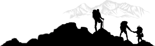
Surya Top Trek
- Through the Magical Meadows of Uttarkashi
- ON REQUEST per person onwards
- 6N/7D / 3,930 m / 31 km / Moderate / Best: March-June
- Easy to Moderate
- Transport Included
- Certified Guides
- Group Size: 20
Duration
6N/7D
Max Elevation
3,749 m
Gradient
Moderate
Distance
31 km
Best Month
March-June
Group Size
20
Starting From
ON REQUEST
- Overview
Surya Top Trek — Overview
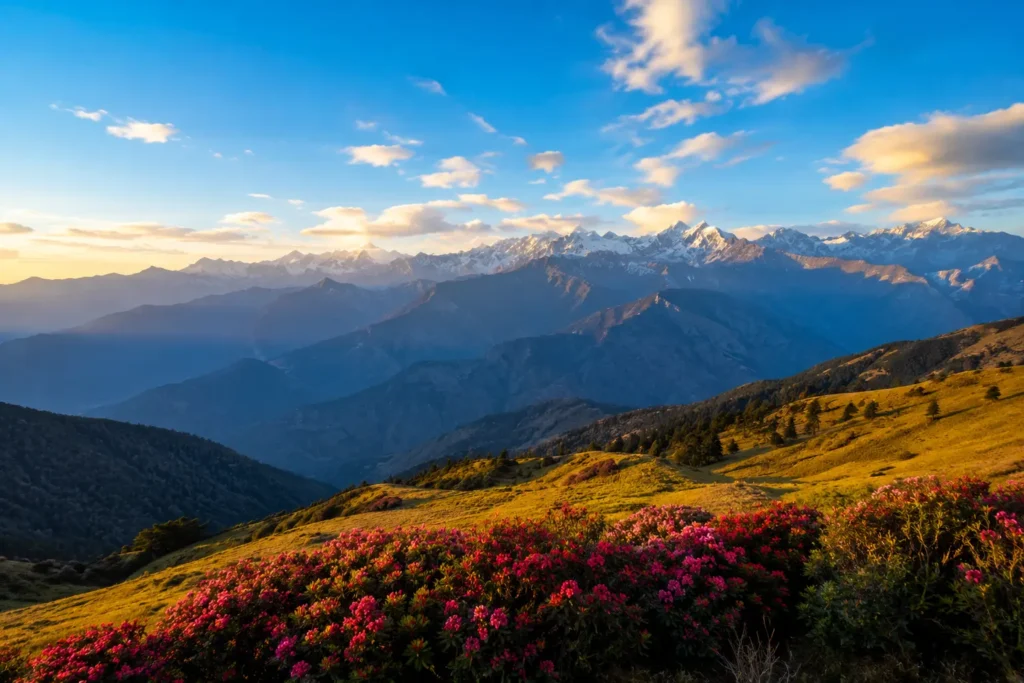
We, at Mountainiax, love to organize offbeat treks — and the Surya Top Trek is one of our most breathtaking and lesser-explored trails in the Garhwal Himalayas. An extension of the famous Dayara Bugyal Trek, this journey takes you through vast meadows, dense forests, and stunning ridge walks, all leading up to the magnificent Surya Top which offers a 360-degree panoramic view of the Himalayas. Unlike crowded trekking routes, Surya Top retains its untouched charm, making it a perfect escape into the wilderness.
The adventure begins in Barsu village, a scenic hamlet that marks the starting point of this mesmerizing trek. As you step onto the trail, you’ll find yourself surrounded by lush forests of oak, rhododendron, maple, and cedar, with occasional openings revealing glimpses of the mighty peaks in the distance.
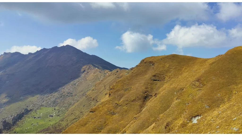
One of the most unforgettable experiences of this trek is the grand ridge walk from Surya Top to Devkund. There are very few treks in India that offer such an extensive and breathtaking ridge walk. As you ascend, the Gangotri and Yamunotri ranges emerge on the horizon — Bhagirathi I & II, Mt. Meru, Thalay Sagar, Kedardome, Bandarpoonch I & II, and Kalanag make their presence felt, forming a spectacular backdrop against the open sky. Camping at Devkund with the colossal Bandarpunch massif right in front of you is an experience that stays with you long after the trek ends
- Complete Information
Quick Facts
Base Camp
Barsu Village, Uttarkashi
Pickup
Near Dehradun Railway Station
Nearest Railway Station
Dehradun
Nearest Airport
Jolly Grant Airport, Dehradun
Temperature
Day: 18-22°C | Night: 2° to -8°C (spring/autumn)
Mobile Network
Barsu: Jio/Airtel available. No network on trail.
Electricity
Barsu village only. No electricity on trail.
Last ATM
Uttarkashi, on the way to Barsu. Carry cash.
- Day by Day
Detailed Itinerary — Surya Top Trek
1
DAY
- Dehradun → Barsu Village
- 🛣️ 165 km Drive
- ⏱️ 7-8 Hrs
- 📍 Barsu: 2,740m
Drive from Dehradun through the scenic Yamuna valley, passing Mussoorie, Barkot, and Uttarkashi to reach Barsu Village — the charming and scenic base camp for the Surya Top Trek. The village is nestled in the Uttarkashi district and offers a warm, authentic Garhwali experience. Overnight stay in guesthouse.
2
DAY
- Barsu → Dayara Bugyal
- 🥾 7 km Trek
- ⏱️ 4-5 Hrs
- 📍 Dayara: 3,408m
Trek through dense oak and rhododendron forests from Barsu, gradually ascending to the magnificent Dayara Bugyal — one of the most beautiful high-altitude meadows in Uttarkashi district. The meadow offers sweeping views of the surrounding peaks. Camping in the vast meadow.
3
DAY
- Dayara Bugyal → Surya Top
- 🥾 8 km Trek
- ⏱️ 5-6 Hrs
- 📍 Surya Top: 3,930m
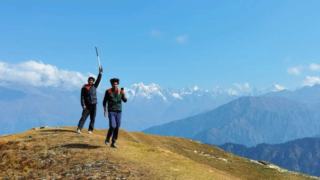
Ascend from Dayara Bugyal to the magnificent Surya Top ridge. As you gain altitude, the panorama unfolds dramatically — the Gangotri range, Yamunotri range, Bandarpunch, Kalanag, and dozens of peaks appear in a single 360° sweep. The feeling of standing on the Surya Top ridge with clouds drifting below and the vast Himalayan landscape unfolding in every direction is nothing short of magical.
4
DAY
- Surya Top Ridge Walk → Devkund
- 🥾 7 km Trek
- ⏱️ 4-5 Hrs
The grand ridge walk from Surya Top to Devkund — one of the finest ridge walks in Indian trekking. Walk along the ridge with views on both sides as you traverse through alpine terrain. Bhagirathi I & II, Mt. Meru, Thalay Sagar, Kedardome, Bandarpoonch I & II, and Kalanag accompany you on this ridge walk. Descend to the stunning Devkund campsite — imagine waking up to the colossal Bandarpunch massif right in front of you, its snowy peaks glowing in the soft light of dawn.
5
DAY
- Devkund → Dayara Bugyal → Barsu
- 🥾 10 km Trek
- ⏱️ 5-6 Hrs
Begin the return journey through Dayara Bugyal and back through the beautiful forest to Barsu village. Overnight stay at guesthouse.
6
DAY
- Barsu → Uttarkashi → Dehradun
- 🛣️ 165 km Drive
- ⏱️ 7-8 Hrs
Return journey to Dehradun through the scenic mountains, completing a spectacular and uniquely offbeat Himalayan adventure that very few trekkers have experienced.
- Be Prepared
Things to Carry
- 🎒 Basic Gear
- Backpack
- Trekking Shoes
- Trekking Pole
- LED Torch
- One Water Bottle (1 litre)
- Lunch Box
- Basic / Prescribed Medications
- 🧥 Clothes
- Trekking Jacket
- Warm Layers
- Two Trek Pants
- Full Sleeve Dry-fit T-shirts
- Thermals (1 pair)
- 🕶️ Accessories
- Sunglasses
- Sunscreen Lotion (SPF 50/70)
- Lip Balm (SPF 30)
- Synthetic Hand Gloves
- Woolen Cap
- Three Pairs of Socks
- Raincoat / Poncho (must)
- 📄 Documents & Others
- Daypack (for Summit Day)
- Plastic cover for wet clothes
- Original + photocopy of Govt Photo ID (Passport / Aadhaar / Driving License / Voter ID)
Surya Top Trek — Package & Cost
Budget
- 6 Nights / 7 Days
- Starting from: Dehradun
- Transport: Pickup to Drop included
- Dormitory / triple sharing accommodation
- All vegetarian meals included
- Certified trek guide and support staff
- Forest entry permits and camping fees
- Sleeping bags, mats, and tents
Limited seats — call +91 6398937502
- Choose Your Plan
- What's Covered
Inclusions & Exclusions
- ✅ Included
- Transport support from Dehradun to Dehradun.
- All vegetarian meals starting from dinner on Day 1 to breakfast on the last day.
- Guesthouse accommodation in Barsu (triple sharing) for first and last day.
- Triple sharing tent accommodation throughout the trek.
- Experienced guide, cook and support staff.
- Camping equipment — sleeping bags, mats, quality tents, kitchen and toilet tents.
- Forest entry charges for Indian nationals.
- Porter and mule support to carry camping equipment.
- All applicable taxes.
- ❌ Excluded
- Personal expenses like tips, personal medicines, phone calls etc.
- Any transport support during the trek apart from what is included above.
- Any cost or services not mentioned in the Inclusions.
- Accommodation in Dehradun / Rishikesh before or after the trek.
- Cost arising due to unforeseen incidents like bad weather, medical evacuation, road blocks etc.
- Porter/mule charges to carry personal luggage — can be arranged at ₹500/day (1 soft bag per person, max 12 kg).
- Important
Cancellation & Refund Policy
Cancellation Policy
We understand that plans can change. If you need to cancel, reduce, or amend a guaranteed reservation, please do so by 12 noon, 15 days prior to arrival to avoid cancellation charges. Any cancellation made within 15 days of arrival will be 100% non-refundable.
No cancellations will be accepted over the phone or via WhatsApp message. Please reply to the email confirmation you received at the time of booking to request a cancellation.
No refunds will be provided in case of problems arising due to government orders, harsh weather conditions, protests, landslides, or other unforeseen circumstances. If a trek is called off at the last moment due to natural calamities, participants will be provided with a travel voucher for the same amount, valid within 365 days for any package of equal value.
Refund Policy
| Cancellation Timing | Refund |
|---|---|
| Up to 21 days prior to departure | 70% refund |
| Between 21 to 14 days prior | 50% refund |
| Between 14 to 10 days prior | 30% refund |
| Less than 10 days of departure | No refund (can transfer trek to someone else) |
Note: Refunds are subjected to deductions for any expenses incurred for hotel booking or transport. Refunds are applicable on the total cost and not on the advance amount.
- Plan Your Trip
Best Time to Visit Surya Top Trek
- ⭐ Best
Apr-Jun
Spring/Summer
- ✅ Good
Oct-Nov
Post-Monsoon
Golden meadows, crisp air, exceptional visibility of Gangotri and Yamunotri ranges from the ridge.
- ⚠️ Avoid
Jul-Aug
Monsoon
- ❄️ Closed
Dec-Mar
Winter
- Why Mountainiax
Trusted by Thousands of Trekkers
- 🏛️
Govt Registered Company
Fully registered travel operator with valid GSTIN and all required tourism licenses. Your money is safe with us.
- 🧭
Certified & Experienced Guides
Our trek coordinators and guides have 8+ years of experience on the Surya Top Trek route. They know every turn, every campsite.
- ⭐
4.9★ on Google & TripAdvisor
Trusted by 1000+ trekkers across 100+ successful Surya Top Trek batches. Consistently rated best-in-class for safety and experience.
- 🕐
On-Time Operations
Punctual pickups, pre-booked guesthouses, and well-planned itineraries. No last-minute surprises or hidden costs.
- 📞
24/7 Support During Trek
Dedicated trip coordinator with you throughout. 24-hour call assistance for any emergency or query during the trek.
- 👨👩👧
Beginner & Group Friendly
Perfect first Himalayan trek. We manage solo trekkers, groups, corporate teams, and college trips with equal expertise.
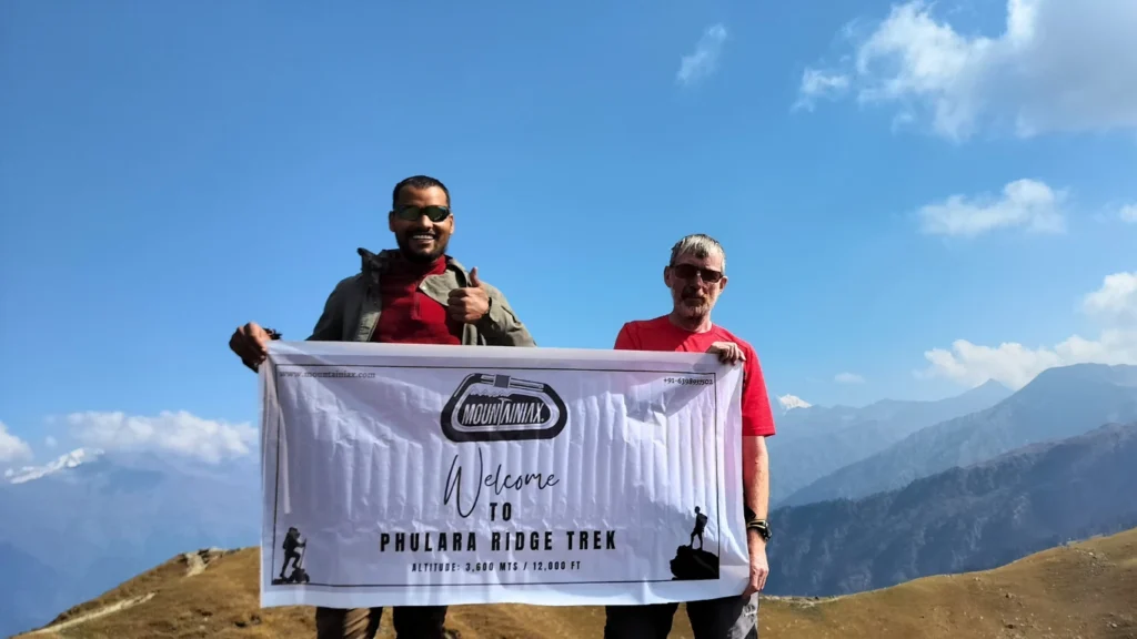
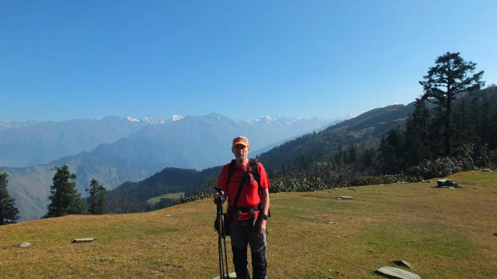
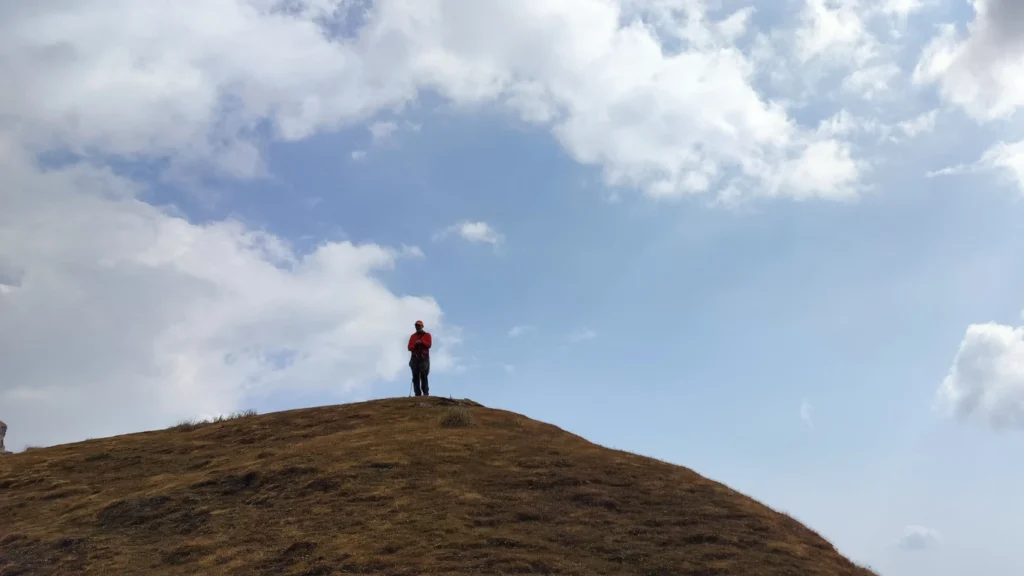
- Visual Journey
Surya Top Trek Gallery
- Need Help?
Frequently Asked Questions
How many days is the Surya Top Trek?
What is the difficulty level of the Surya Top Trek?
What is the best time to do the Surya Top Trek?
What is the altitude of Surya Top?
Where does the Surya Top Trek start?
Is the Surya Top Trek the same as the Dayara Bugyal Trek?
How do I reach the base camp, and what's the pickup point?
Is the Surya Top Trek suitable for beginners? How fit do I need to be?
Which peaks are visible from Surya Top?
- Ready to Trek?
Book Your Free Trek
Consultation Today
With Free Itinerary Planning Session — Limited Slots Available!
- +91-6398937502 | +91-7887449236