- 4.8/5 · 1000+ Trekkers · Beginner Friendly
Kedarkantha Trek 2026
- The Queen of Winter Treks
- Govind Pashu Vihar National Park, Uttarakhand, India
- Nov–March Season | 4N/5D from Rishikesh | Starting from ₹6,599/-
- Easy to Moderate
- Transport Included
- Certified Guides
- Group Size: 20
Duration
4N / 5D
Max Elevation
3,849 m
Gradient
Easy–Mod
Distance
20 km
Best Month
Nov–Mar
Group Size
20
Starting From
₹6,599
- Overview
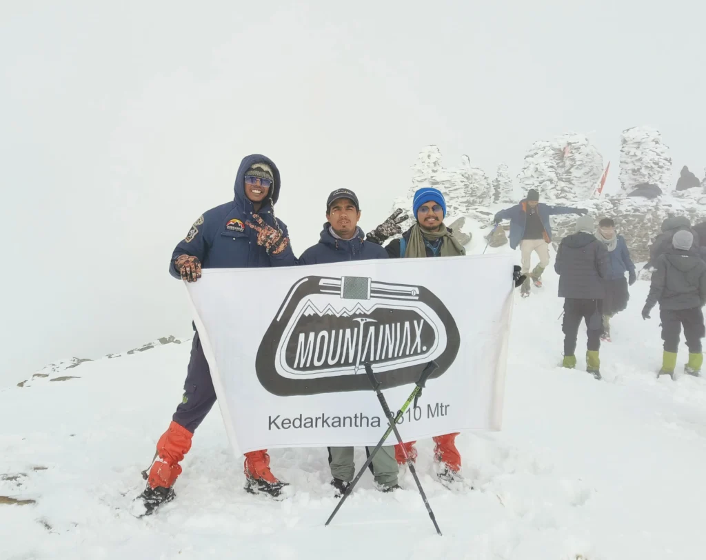
Kedarkantha Trek — Overview
Embark on an adventurous journey to Kedarkantha Peak, a beginner-friendly trek nestled in the ridge peak of the Tons River valley, accessible year-round. Located at an altitude of 3800 meters within Govind Pashu National Park and Sanctuary, Kedarkantha Peak offers an unparalleled winter trekking experience in Uttarakhand, resembling a fairytale gateway to a magnificent and remarkable summit. The name Kedarkantha, translating to “Throat of Lord Shiva,” carries a tale that resonates through the ages. It embodies the belief that Uttarakhand is a haven for a mystical, harmonious, and natural lifestyle. The name itself is derived from “Kedar,” one of the names of Lord Shiva, and “Kantha,” meaning throat. This peak holds a storied past; legend has it that Lord Shiva meditated here in solitude, evading the Pandavas. It is said that during his meditation, the sound of a calf led Lord Shiva to realize the proximity of civilization, prompting him to move to Kedarnath, the holy shrine of Chota Char Dham. The trek to Kedarkantha is less exhaustive yet visually stunning, offering a plethora of changing landscapes within the national park area. The journey begins with an enchanting trail through pine and rhododendron forests, past lands once cultivated for potatoes and apples by the locals. As you ascend, you will encounter Juda Ka Talab, a sacred lake surrounded by densely forested pine trees, offering breathtaking views in any weather condition. This lake is steeped in mythology, and believed to have been created from a droplet that fell from Lord Shiva’s hair bun. The ascent culminates at Kedarkantha Peak, where a flat summit provides a majestic 360-degree view of the Himalayan snow-capped mountains, including Swargarohini, Bandarpunch, and many others. Reaching the peak might leave you in awe, as if entering a new realm of existence, with the vast Himalayas draped in a snowy blanket. If you live for moments like this, the Kedarkantha trek offers profound insights and breathtaking vistas. For those seeking an unforgettable winter trekking experience, Kedarkantha is a perfect choice, featuring rich vegetation and diverse landscapes, from serene lakes to snow-covered peaks. Join us on this incredible adventure and create memories that will last a lifetime in the heart of the Himalayas.
- Complete Information
Quick Facts
Base Camp
Sankri
Pickup
Dehradun
Nearest Railway Station
Dehradun
Nearest Airport
Jolly Grant Airport
Temperature
Summers: 25° Max / 10° Min Winters: 18° Max / -5° Min
Mobile Network
Lohajung: Jio/Airtel/VI available During trek: No network
Electricity
Lohajung is the last point with electricity. Extremely intermittent in winter/monsoon season.
Last ATM
Dehradun
- Day by Day
Detailed Itinerary
1
DAY
- Dehradun to Sankri
- Distance: 199 km (Drive) Duration: 8 Hours
- Altitude: Dehradun – 477 meters, Sankri – 1920 meters
Begin your morning in Dehradun, the capital of Uttarakhand, and set off on a drive that transitions from the urban setting into the heart of the mountains. The journey offers scenic vistas as you pass through the bustling markets of hilly towns such as Mussoorie, Nainbagh, Damta, Naugaon, Purola, and Mori. Travel alongside the serene rivers Yamuna, Tons, and Kamal Ganga. In Netwar, witness the confluence of the Supin and Tons rivers. The route features meandering paths lined with pine trees and sharp curves that enhance the drive’s excitement. Upon arrival in Sankri, the distant peaks of Swargarohini glisten in the horizon. Spend the night in a local homestay near Sankri Road’s main market, ready for the adventures ahead.
2
DAY
- Sankri to Juda ka Talab
- Distance: 4 km (Trek)
- Time: 5 hours
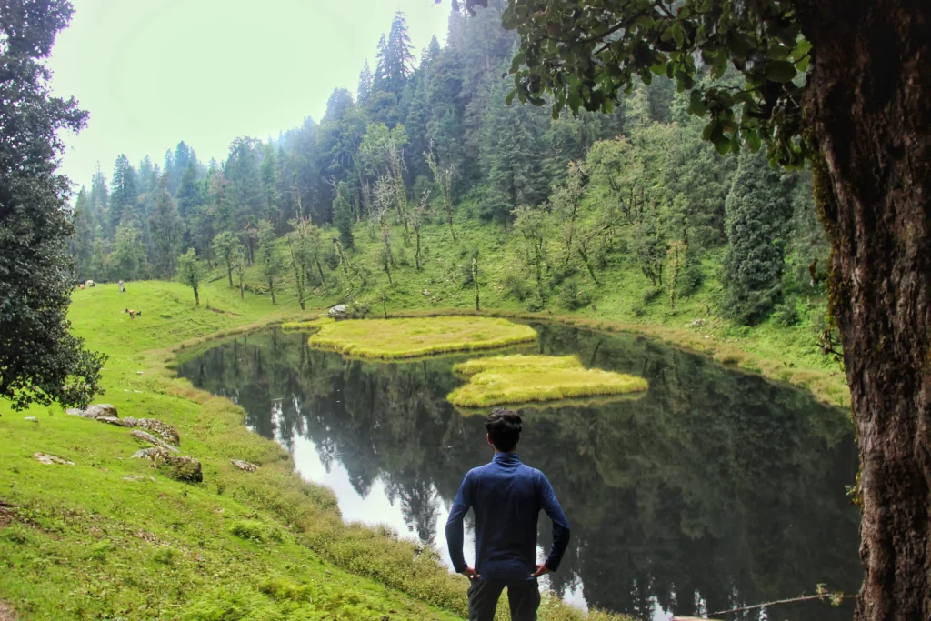
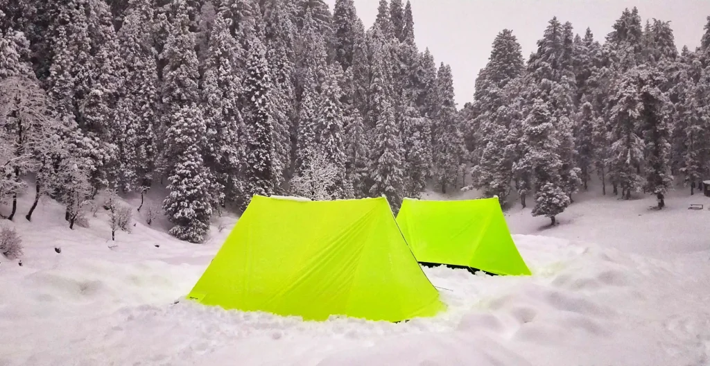
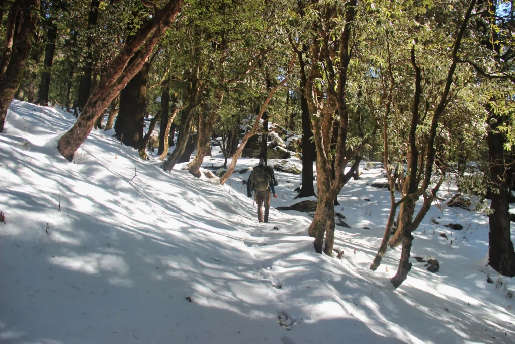
After breakfast in Sankri, the trek to Juda Ka Talab begins, passing through the quaint village of Saud situated along the ridge of the Tons River valley. The trail soon diverges into a forested path where thick pine and maple trees shield trekkers from the sun. This enchanting route leads up to Juda Ka Talab, where tents are pitched beside a stunningly frozen lake, surrounded by snow and dense pine forests. Enjoy dinner under a starlit sky at this breathtaking high-altitude location.
3
DAY
- Trek to Kedarkantha Base camp
- Distance: 2 km (Trek)
- Time: 2 Hours
Trek from base camp to the legendary Juda Ka Talab — a sacred glacial lake surrounded by densely forested pine trees, offering breathToday’s trek is more challenging, with a steeper ascent. Departing Juda Ka Talab, the path splits; take the left fork which climbs through dense pine forests. Along the way, encounter shelters transformed into makeshift shops by locals. Reaching the Base Camp unveils stunning views of the Kedarkantha summit. Prepare for an early night, as the ascent to the summit begins at 3 A.M.taking views in any weather condition. This lake is steeped in mythology, believed to have been created from a droplet that fell from Lord Shiva’s hair bun. In winter, the lake freezes completely, creating an enchanting mirror-like expanse. Camp overnight by the lakeside.
4
DAY
- Kedarkantha Summit and return to Base Camp
- Distance: 6 km (Trek)
- Time: 6 Hours
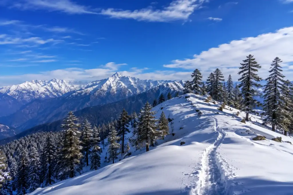
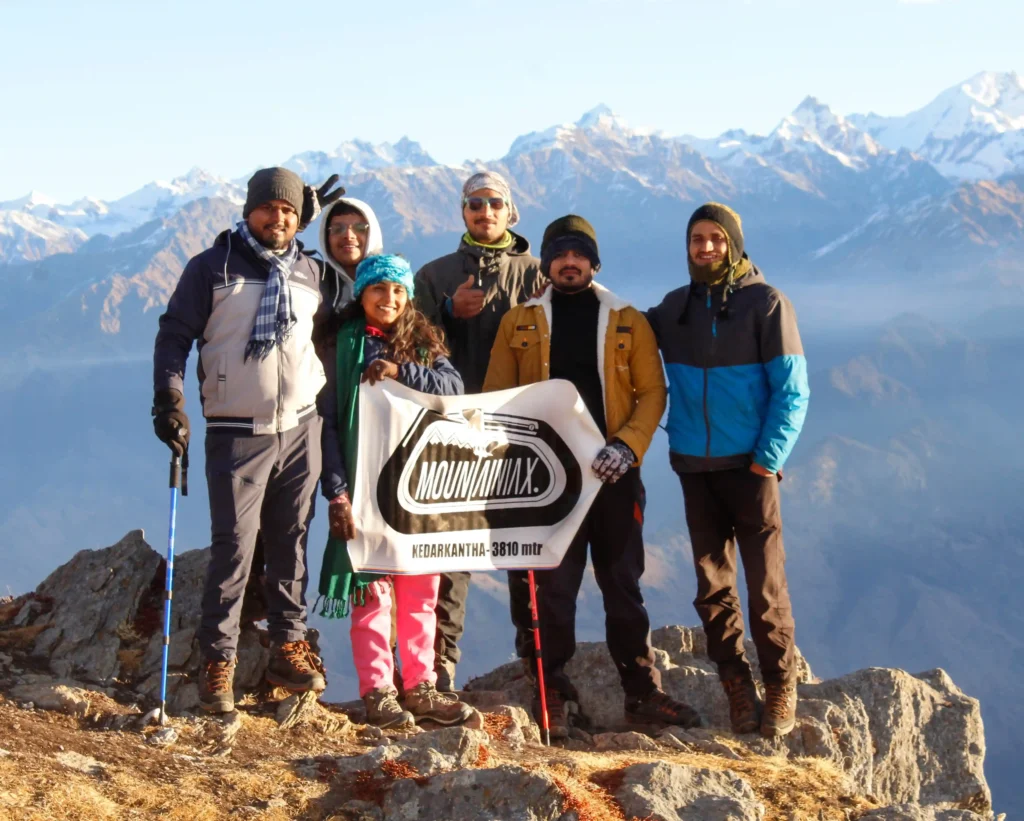
An early start leads to a challenging two-hour hike to a tea point where the tree line ends, opening up to spectacular Himalayan vistas. The summit of Kedarkantha is a haven for snow enthusiasts and photographers alike, featuring small temples dedicated to Lord Shiva and Lord Ganesha. Spend time absorbing the panoramic views of the Himalayas, including the prominent peaks of Swargarohini, Black Peak, Bandarpoonch, Gangotri, and Yamunotri ranges. Return to Base Camp for a well-deserved rest under the cold night sky.
5
DAY
- Return to Sankri and journey back to Dehradun
- Distance: 6 km (Trek) back to Sankri, 199 km (Drive) to Dehradun
- Time: 3-4 Hours trek, 8 Hours drive
The final leg of the trek leads back to Sankri via a different route, passing through the campsite at Hargaon. The return drive to Dehradun travels through picturesque settings, transitioning from serene mountain landscapes back into the lively urban environment. Reflect on a memorable adventure as you approach Dehradun, bringing the journey to a close.
- Be Prepared
Things to Carry
- 🎒 Basic Gear
- Backpack
- Trekking Shoes
- Trekking Pole
- LED Torch
- One Water Bottle (1 litre)
- Lunch Box
- Basic / Prescribed Medications
- 🧥 Clothes
- Trekking Jacket
- Warm Layers
- Two Trek Pants
- Full Sleeve Dry-fit T-shirts
- Thermals (1 pair)
- 🕶️ Accessories
- Sunglasses
- Sunscreen Lotion (SPF 50/70)
- Lip Balm (SPF 30)
- Synthetic Hand Gloves
- Woolen Cap
- Three Pairs of Socks
- Raincoat / Poncho (must)
- 📄 Documents & Others
- Daypack (for Summit Day)
- Plastic cover for wet clothes
- Original + photocopy of Govt Photo ID (Passport / Aadhaar / Driving License / Voter ID)
Kedarkantha Trek Packages 2026
Budget
- 4 Nights / 5 Days
- Starting from: Delhi | Kathgodam
- Transport: Rishikesh to Rishikesh
- Dormitory / triple sharing accommodation
- All vegetarian meals (dinner Day 1 to breakfast Day 5)
- Experienced certified trek guide
- Forest entry permit & camping fees
- Camping equipment, sleeping bags & mats
Limited seats — call +91 6398937502
- Choose Your Plan
- What's Covered
Inclusions & Exclusions
- ✅ Included
- Transport support from Dehradun to Dehradun
- Meals from Day 1 Dinner to breakfast on day 5.
- Hotel accommodation throughout the trek on a Quad sharing basis
- Professional guide, and support staff
- Comfortable tented Accommodation
- Forest entry charges for Indian nationals.
- Tolls and taxes included
- ❌ Excluded
- Personal expenses like tips, personal medicines, phone calls etc
- Any transport support during the trek apart from what is included above
- Any cost or services not mentioned in the Inclusions
- Cost arising due to unforeseen incidents like bad weather, medical evacuation, road blocks etc
- Porter/mule charges to carry personal luggage can be arranged at an additional cost of INR 500 per day (1 soft bag per person < 12 kg)
- Important
Cancellation & Refund Policy
Cancellation Policy
We understand that plans can change. If you need to cancel, reduce, or amend a guaranteed reservation, please do so by 12 noon, 15 days prior to arrival to avoid cancellation charges. Any cancellation made within 15 days of arrival will be 100% non-refundable.
No cancellations will be accepted over the phone or via WhatsApp message. Please reply to the email confirmation you received at the time of booking to request a cancellation.
No refunds will be provided in case of problems arising due to government orders, harsh weather conditions, protests, landslides, or other unforeseen circumstances. If a trek is called off at the last moment due to natural calamities, participants will be provided with a travel voucher for the same amount, valid within 365 days for any package of equal value.
Refund Policy
| Cancellation Timing | Refund |
|---|---|
| Up to 21 days prior to departure | 70% refund |
| Between 21 to 14 days prior | 50% refund |
| Between 14 to 10 days prior | 30% refund |
| Less than 10 days of departure | No refund (can transfer trek to someone else) |
Note: Refunds are subjected to deductions for any expenses incurred for hotel booking or transport. Refunds are applicable on the total cost and not on the advance amount.
- Plan Your Trip
Best Time to Visit
- ⭐ Best
Dec–Feb
Peak Snow Season
Fresh deep snow 4–6 ft, winter wonderland, Christmas & New Year special batches, magical summit sunrise
- ✅ Good
Nov
Early Winter
First snowfall, crystal clear skies, fewer crowds, comfortable temperatures on trail
- ✅ Good
Mar–Apr
Late Winter
Melting snow, rhododendrons in bloom, excellent views, last snow treks of the season
- ⭐ Best
May–Oct
Monsoon / Summer
Heavy rain, leeches on trail, slippery paths, reduced visibility. No snow on the ground.
- Why Mountainiax
Trusted by Thousands of Trekkers
- 🧑🤝🧑
PROFESSIONAL TEAM
If you book your trek with us you'll be going with a team of our highly skilled professional trainers. Client safety is our first priority.
- 📝
Certified Organisation
We are registered with Uttarakhand Tourism Department and MSME.
- ⭐
4.9★ on Google & TripAdvisor
Trusted by 1000+ trekkers across 100+ successful Kedarkantha batches. Consistently rated best-in-class for safety and experience.
- 🗺️
Traveller's Choice (TRIPADVISOR)
Awarded as Travellers Choice by Tripadvisor for 2021 & 2022. With 140+ positive reviews we are ranked amongst Top 5 Outdoor Company in Dehradun.
- 📞
CUSTOMIZED TREK
Are you exhausted with the same old trekking packages? Mountainiax offers comfort for travelers to design and arrange your plans independently.
- 👨👩👧
AWAY FROM THE CROWD
The mission of our committee is to explore the unmapped trails in different regions and make our customers visit these offbeat destinations to enjoy in solitude.
- Visual Journey
Kedarkantha Trek Gallery
- Need Help?
Frequently Asked Questions
What is the difficulty level of Kedarkantha Trek?
What is the best time for Kedarkantha Trek?
Is mobile network available during the trek?
Is electricity available during the trek?
Where can I store my extra luggage during the trek?
Is Kedarkantha Trek suitable for someone with no prior trekking experience?
What is the pickup point and time?
How to book the Kedarkantha Trek with Mountainiax?
- Ready to Trek?
Book Your Free Trek
Consultation Today
With Free Itinerary Planning Session — Limited Slots Available!
- +91-6398937502 | +91-7887449236