Winter in the Garhwal Himalayas operates at a different register from anything else on the Indian trekking calendar. Snow buries the oak forests, high-altitude lakes freeze into still mirrors, and the ridgelines open views that simply do not exist in the warmer months. The Brahmatal Trek sits at the centre of this experience — a 4-night, 5-day route through the Chamoli district that earns its standing not on a single dramatic highlight but on the quality of everything it delivers across four trekking days.
The route begins at Lohajung base camp (1,760 m) and climbs through dense rhododendron and oak forest to two frozen high-altitude lakes — Bekaltal and Brahmatal — before reaching the summit at Brahmatal Top (3,730 m). From that ridge, the Garhwal giants spread across the skyline: Mt. Trishul (7,120 m), Nanda Ghunti (6,309 m), Chaukhamba (7,138 m), Neelkanth, Mana, Maiktoli, and the Hathi-Gauri group.
Quick Facts at a Glance
| Trek Information | Details |
| Region | Chamoli Garhwal |
| Duration | 4 Nights / 5 Days |
| Maximum Altitude | 3,730 m (12,238 ft) – Brahmatal Top / Jhandi Top |
| Trek Distance | Approximately 23 km |
| Difficulty Level | Easy to Moderate |
| Base Camp | Lohajung (1,760 m) |
| Pickup Point | Natraj Chowk, Rishikesh |
| Nearest Railway Station | Rishikesh |
| Nearest Airport | Jolly Grant Airport, Dehradun |
| Best Season | November–March (Snow Trek) March–May (Rhododendron Bloom) |
| Temperature | Summer: Up to 25°C Winter (Base Camp): Down to –5°C High Camps (Jan–Feb): –10°C to –15°C |
| Mobile Network | Jio, Airtel & VI available at Lohajung only; no network coverage on the trail |
| Last ATM | Srinagar (on the Rishikesh–Lohajung route) |
| Starting Price | ₹5,500 per person (Lohajung to Lohajung) ₹7,499 per person (Rishikesh to Rishikesh) |
| Group Size | Maximum 20 Trekkers per Batch |
Why the Brahmatal Trek Deserves a Place on Your 2026 List
Most treks at this altitude offer one central draw — a summit view, a notable lake, or a striking forest stretch. What separates Brahmatal is that it never reduces to a single payoff. Rewards arrive reliably from Day 2 onwards and continue through the summit descent, giving the route a narrative quality that most Easy-Moderate equivalents cannot match.
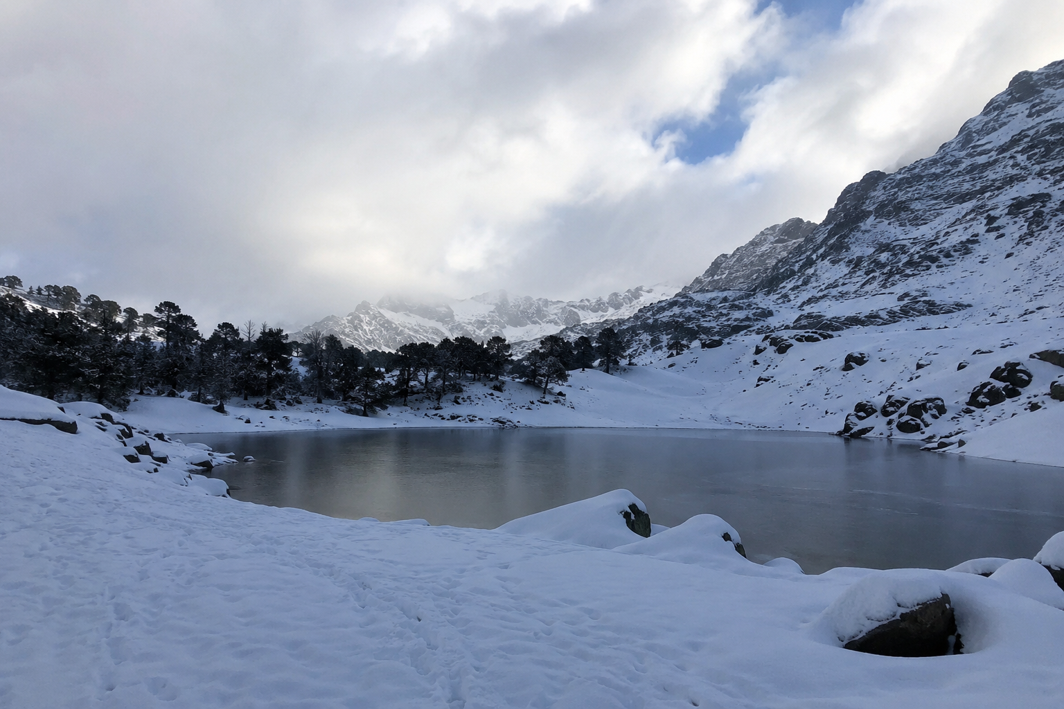
Two contrasting high-altitude lakes. Bekaltal, at 3,012 m, sits within a quiet oak-lined basin and in winter becomes a frozen spectacle framed by snow-covered branches. Brahmatal Lake at approximately 3,660 m occupies a very different environment — open, stark, and set against the full scale of the Garhwal range. The contrast between the two, one forested and intimate, the other alpine and exposed, gives the trek a visual arc that most day-trek equivalents cannot replicate.
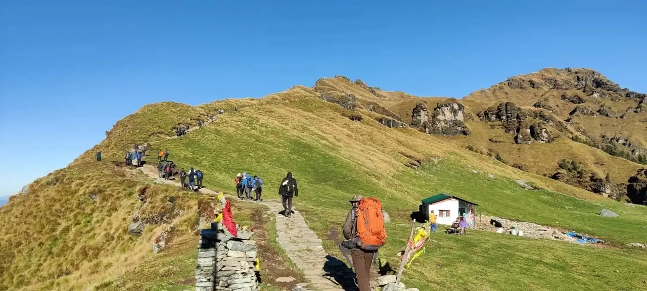
The Jhandi Top ridge traverse. On Day 3, as the trail breaks out from the rhododendron canopy onto the open snowfield of Tilandi Top, the Trishul massif appears at close range. From here the ridge walk to Jhandi Top climbs exposed ground with valleys dropping away on both sides — a section set within the dramatic highland terrain of Chamoli, Uttarakhand.
Spring as a genuine alternative. Trekkers who cannot travel in winter should look closely at the late March to May window. Rhododendron forests bloom red and pink from the lower sections upward, the mornings stay clear, and snow persists on the upper trail — a lighter, more colourful experience without the severe overnight cold of January and February.
Strong comparative value. Brahmatal is easier than Kedarkantha on summit day, more visually generous than Nag Tibba, and less demanding in altitude than the Kuari Pass Trek. It sits in a bracket that asks for preparation and fitness but not prior mountaineering experience — one of the most sensible first winter trek choices in the Indian Himalaya.
Best Time to Visit
Winter: December to March
This is the definitive window. Snow covers the trail from Lohajung upward, both lakes freeze solid, and overnight temperatures at the higher camps fall to –10°C to –15°C in January and February. January delivers the deepest snow and the clearest skies. February maintains full trail conditions with marginally less severe cold. March is the gentler entry into the winter window — snow begins retreating from the lower sections by mid-month but the summit zone stays well-covered.
Spring: March to May
Late March through May transforms the trail entirely. Approach forests come alive with rhododendron bloom, mornings stay clear for strong summit views, and snow persists at the lake and summit without requiring heavy winter layering at lower altitude.
Autumn: October to November
October and November bring stable weather and firm trail conditions. The first dusting of snow arrives on the higher ridges by mid-November. Crowds are thinner than the winter peak, making this a practical option for trekkers with tight schedules who prefer a quieter trail.
Avoid: June through mid-September. Monsoon rains make the lower forest slippery, leech activity is high, and camping conditions at altitude deteriorate sharply.
Day-by-Day Itinerary
For a trek package page, this format is cleaner, easier to read, and more professional:
| Day | Route | Distance | Duration | Altitude |
| Day 1 | Rishikesh to Lohajung (Drive) | ~270 km | 10–12 hrs | 1,760 m |
| Day 2 | Lohajung to Bekaltal | 6 km | 4–5 hrs | 3,012 m |
| Day 3 | Bekaltal to Brahmatal Camp via Jhandi Top | 7 km | 5–6 hrs | 3,730 m |
| Day 4 | Brahmatal Top Summit & Descent to Lohajung | ~15 km | 6–7 hrs | 3,730 m |
| Day 5 | Lohajung to Rishikesh (Drive) | ~270 km | 10–11 hrs | — |
Detailed Itinerary
Brahmatal Trek is a 5-day Himalayan trek featuring snow-covered trails, frozen lakes, dense forests, and stunning summit views of Trishul, Nanda Ghunti, Chaukhamba, and other majestic Himalayan peaks.
Day 1: Rishikesh to Lohajung (Drive)
Distance: ~270 km | Duration: 10–12 Hours | Altitude: 1,760 m
The journey begins from Natraj Chowk, Rishikesh at 6:30 AM. Drive through the scenic confluences of Devprayag, Rudraprayag, and Karanprayag before reaching Lohajung by evening. Overnight stay in a guesthouse or homestay. It is advisable to carry all essential trekking gear in advance.
Day 2: Lohajung to Bekaltal
Distance: 6 km | Duration: 4–5 Hours | Altitude: 3,012 m
The trek starts with a gradual climb through dense oak, cedar, fir, and conifer forests. As altitude increases, snow-covered landscapes begin to dominate the trail. Enjoy the first glimpses of Nanda Ghunti before reaching the beautiful Bekaltal campsite beside the frozen lake.
Day 3: Bekaltal to Brahmatal Camp via Jhandi Top
Distance: 7 km | Duration: 5–6 Hours | Altitude: 3,730 m
One of the most scenic days of the trek. The trail ascends through forests before opening into vast snowfields. Spectacular views of Mt. Trishul and Nanda Ghunti accompany the ridge walk to Jhandi Top. After enjoying panoramic Himalayan vistas, descend gradually to the Brahmatal campsite near the frozen lake.
Day 4: Brahmatal Top Summit and Descent to Lohajung
Distance: ~15 km | Duration: 6–7 Hours | Summit Altitude: 3,730 m
Begin early for the summit climb through Chota Jhandidar and Bada Jhandidar. The summit rewards trekkers with breathtaking 360° views of Trishul, Nanda Ghunti, Chaukhamba, Neelkanth, Mana, Maiktoli, and other Himalayan peaks. After spending time at the summit, descend through beautiful oak and rhododendron forests to Lohajung.
Day 5: Lohajung to Rishikesh (Drive)
Distance: ~270 km | Duration: 10–11 Hours
Depart Lohajung early in the morning and drive back through the Garhwal Himalayas. Reach Rishikesh by evening, marking the end of the Brahmatal Trek adventure.
Difficulty Level and Fitness Requirements
The Brahmatal Trek difficulty is rated Easy to Moderate. The two steepest sections are the initial climb from Lohajung to Bekaltal (approximately 1,630 ft over 4.5 km) and the ridge ascent to Jhandi Top on Day 3 (approximately 1,755 ft over 3.5 km). Every other segment is a gradual ascent or controlled descent. Daily trekking hours range from 4 to 7 hours. No technical climbing, ice axes, or ropes are required.
- Fitness benchmark: A continuous brisk walk of 2 hours without rest, or a 5 km run in under 40 minutes. Begin training 4–6 weeks before your trek date. Running, stair training, and cycling are the most effective exercises for this altitude profile.
- Age range: Minimum 10 years. Maximum 65 years with a confirmed doctor’s clearance. Trekkers with cardiovascular conditions or uncontrolled blood pressure should consult a physician before booking.
- Microspikes: Strongly recommended for the Chota Jhandidar and Bada Jhandidar sections on summit day in January and February, when overnight temperatures harden snow into icy crust on the exposed ridge.
Complete Packing List
Pack light but prioritize warm layers, waterproof gear, and sun protection, as temperatures can drop to –15°C at higher camps during winter.
Core Gear
• 40–50 litre backpack
• Waterproof trekking shoes with ankle support
• Trekking poles — mandatory on snow sections
• LED headlamp with spare batteries
• 1-litre insulated water bottle
• Daypack for summit day
Winter Clothing
• Thermal inner layers — top and bottom (minimum 1 set, ideally 2)
• 2–3 full-sleeve dry-fit T-shirts
• Fleece mid-layer
• Insulated down jacket rated to at least –10°C
• Waterproof hardshell outer jacket
• 2 pairs of windproof trekking trousers
• Waterproof rain poncho
• Synthetic hand gloves and liner gloves
• Woollen cap and balaclava
• 3 pairs of warm wool or synthetic socks
Accessories and Documents
• UV-protection sunglasses — essential above 3,000 m; snow blindness risk is real on open ridge sections
• Sunscreen SPF 50+ and lip balm SPF 30
• Plastic bags for wet gear and electronics
• Government photo ID — Aadhaar card, passport, or driving licence (original and one photocopy)
• Personal first aid kit, ORS sachets, prescribed medications
• Diamox — only after prior consultation with a doctor
How to Reach Lohajung Base Camp
Lohajung Base Camp is accessible via Rishikesh or Dehradun by road. The scenic mountain journey passes through Garhwal’s river confluences. Carry sufficient cash, as reliable ATM facilities are limited beyond Srinagar.
From Delhi: Take an overnight train or bus to Rishikesh. Your operator’s cab departs Natraj Chowk, Rishikesh at 6:30 AM on Day 1. The journey covers approximately 270 km and takes 10–12 hours via Devprayag, Rudraprayag, and Karanprayag.
From Dehradun: Direct road access via Srinagar (Garhwal) and Chamoli — approximately 230 km, 9–10 hours.
Nearest Airport: Jolly Grant Airport, Dehradun, approximately 300 km from Lohajung. Delhi-Dehradun flights operate daily.
ATM Advisory: Withdraw sufficient cash in Srinagar (Garhwal) or Rishikesh before heading up. ATMs in hill towns frequently malfunction, and no reliable ATM exists beyond that point on the Lohajung route.
Safety and Altitude Sickness Guidelines
Acute Mountain Sickness (AMS) can affect trekkers at altitudes above 2,500 m regardless of fitness or prior experience. Brahmatal’s gradual altitude gain across four days reduces risk significantly but does not eliminate it.
• Drink 3–4 litres of water per trekking day. Dehydration is the most common AMS trigger on this route.
• Do not ascend with a persistent or worsening headache. Rest an additional night at your current camp.
• Descend immediately if symptoms progress. Descent is the single most effective treatment for altitude sickness.
• Avoid alcohol at every camp on the trail.
• Carry Diamox only with prior medical advice — it can mask symptoms if taken without guidance.
Our groups are led by certified trek leaders with wilderness first aid training. The 20-trekker group cap ensures individual attention on the mountain throughout. Emergency communication beyond Lohajung relies on guide-to-guide radio systems carried by the operator team.
Spiritual Heritage and Natural Character
The lake at the centre of this trek takes its name from Lord Brahma, the Hindu deity of creation. Local tradition across Chamoli Garhwal villages holds that Brahma chose this high-altitude site for meditation, and the name has remained in continuous use across centuries. In winter, the frozen lake carries a stillness that trekkers consistently describe as unlike anything else at altitude — quiet in a way that is earned rather than incidental.
Rhododendron arboreum — locally called Buransh, the revered state tree of the Garhwal hills — lines the mid-altitude sections in stands that glow red in spring and stand skeletal-white under winter snow. The Himalayan Monal, India’s national bird, inhabits the upper forest zones. Winter tracks of musk deer and occasional snow leopard have been recorded across the Brahmatal zone.
The trail moves through four distinct terrain bands — river valley, dense mixed forest, open meadow, and stark alpine basin — which means no two days on this route feel the same. That variety, as much as the summit view, is what keeps trekkers returning.
Frequently Asked Questions
1. Is the Brahmatal Trek suitable for complete beginners?
Yes. It is one of the most consistently recommended first winter snow treks in India. The trail has no technical sections, altitude gain is gradual across four days, and daily walking distances are manageable. The ability to walk briskly for two continuous hours is a practical readiness test before booking.
2. What is the maximum altitude on the Brahmatal Trek?
The highest point is Brahmatal Top (Jhandi Top) at 3,730 metres (12,238 feet). Brahmatal Lake sits at approximately 3,660 metres. Total altitude gain from Lohajung to the summit is approximately 2,000 metres, spread across three days of ascent.
3. Which month gives the best experience?
January and February offer the deepest snow, frozen lakes, and the clearest summit views — the definitive winter window. December is a strong early-winter option. March retains good snow on the upper sections. Late March to April is the rhododendron window — a lighter, more colourful alternative that still delivers the high-altitude atmosphere.
4. Is the trek open in summer?
The trail is physically accessible in summer (May–June), but the primary highlights — frozen lakes and snow-covered landscape — are absent. Most operators run batches from November through May. Monsoon (July–September) makes the lower trail slippery and leech-prone; camping conditions at altitude deteriorate sharply during this period.
5. What is the total trekking distance?
Approximately 23 km across four active trekking days. Day 2 (Lohajung to Bekaltal) is 6 km. Day 3 (Bekaltal to Brahmatal via Jhandi Top) is 7 km. Day 4 (summit and full descent to Lohajung) covers approximately 15 km.
Conclusion
The Brahmatal Trek remains one of the finest winter treks in the Indian Himalayas, offering an exceptional combination of snow-covered trails, frozen alpine lakes, dense oak and rhododendron forests, and panoramic summit views. Whether you’re a first-time trekker seeking a safe introduction to Himalayan trekking or an experienced adventurer looking for a rewarding winter escape, Brahmatal delivers a complete mountain experience in just five days. From the serene beauty of Bekaltal to the breathtaking views from Brahmatal Top, every stage of the journey offers something memorable. With manageable difficulty, well-planned campsites, and stunning scenery throughout, this trek continues to be a top choice in Uttarakhand. If a Himalayan adventure is on your 2026 bucket list, the Brahmatal Trek deserves a place near the top.
With the Brahmatal Trek season approaching, it’s time to plan something truly extraordinary. From breathtaking Himalayan peaks to spiritually powerful temples hidden deep in remote valleys, this journey offers an experience that goes beyond a typical trek—it becomes a story you carry for life. To make your journey seamless and well-organized, choose the best trekking company in Uttarakhand for reliable trek packages, detailed itineraries, and hassle-free booking.
Visit this page for Trek Packages, Itinerary & Booking.